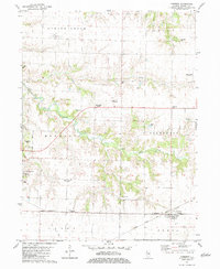
1982 Map of Cameron
USGS Topo · Published 1983About this map
Gerlaw and the surrounding townships of Spring Grove and Kelly anchor the northern landscape of this Warren County survey. The terrain is defined by the drainage of Talbot Creek and Cedar Creek, which create breaks in the otherwise flat agricultural plains of west-central Illinois. Transportation history is deeply etched into the topography, with the Burlington Northern and Atchison Topeka and Santa Fe lines running parallel in the south, while an Old RR Grade in the northwest hints at retired rail corridors. Local genealogy is well-preserved through family-named sites like Terpening Cem, Mosher Cem, and Ogden Cem. The map captures the interface between the growing eastern edge of Monmouth and the smaller, traditional settlements of Coldbrook and Cameron, showing the rural character of the region as it transitioned in the late twentieth century.
Find a feature on this map
31 named features on this map. Tap any name to fly to it.
Don’t see what you’re looking for? This feature index may not catch every label — zoom into the map to look around manually.
Map Details
Editions of this 1982 Cameron Map
This is the sole edition of this map. No revisions or reprints were ever made.
Other maps of this area

1921 · Monmouth
USGS Topo · 1:62,500

1923 · Monmouth
USGS Topo · 1:62,500

1923 · Alexis
USGS Topo · 1:62,500

1925 · Alexis
USGS Topo · 1:62,500

1925 · Galesburg
USGS Topo · 1:62,500

1927 · Galesburg
USGS Topo · 1:62,500

1947 · Woodhull
USGS Topo · 1:62,500

1958 · Burlington
USGS Topo · 1:250,000

1958 · Davenport
USGS Topo · 1:250,000

1961 · Burlington
USGS Topo · 1:250,000