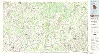
1981 Map of Camilla
USGS Topo · Published 1982About this map
The Flint River meanders south through the heart of this southwest Georgia landscape, defining the agricultural and transport rhythms of Mitchell, Baker, and Early counties in the early 1980s. Significant regional hubs like Camilla, Blakely, and Colquitt anchor a dense network of state routes, including Georgia 91 and Georgia 62. The map details a transition from the rolling terrain near Kolomoki Mounds State Park to the distinctive flats of The Level in the south.
Find a feature on this map
102 named features on this map. Tap any name to fly to it.
Don’t see what you’re looking for? This feature index may not catch every label — zoom into the map to look around manually.
Map Details
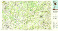
Editions of this 1981 Camilla Map
2 editions found
Other maps of this area

1952 · Bascom
USGS Topo · 1:24,000

1953 · Dothan
USGS Topo · 1:250,000

1953 · Waycross
USGS Topo · 1:250,000

1954 · Dothan
USGS Topo · 1:250,000

1954 · Steam Mill
USGS Topo · 1:24,000

1954 · Desser
USGS Topo · 1:24,000

1954 · Valdosta
USGS Topo · 1:250,000

1954 · Tallahassee
USGS Topo · 1:250,000

1955 · Dothan
USGS Topo · 1:250,000

1955 · Bainbridge
USGS Topo · 1:62,500