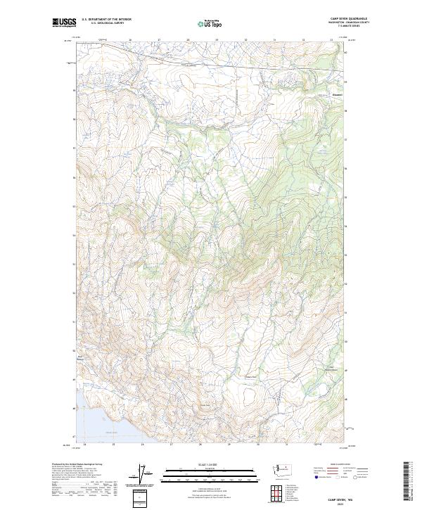
2023 Map of Camp Seven
USGS Topo · Published 2023About this map
Disautel sits in the northeast corner of this Okanogan County landscape, where the high plateau transitions toward the northern shore of Omak Lake. The terrain is defined by a dense network of seasonal drainages and springs that support the cattle-ranching and timber history of the region. Distinctive landmarks such as Bull Pasture and Peters Flat indicate the long-standing use of these open spaces for livestock, while numerous water sources like Quaking Aspen Spring and Wise Camp Spring provide critical points of interest for those studying the local hydrology and land use. To the east, Dan Nason Basin and French Valley show the topographical variations between the ridges and basins. The presence of several Bureau of Indian Affairs (BIA) routes, including BIA Rd 102 and BIA Rd 97, highlights the essential transportation network connecting these high-country settlements and landmarks.
Find a feature on this map
42 named features on this map. Tap any name to fly to it.
Don’t see what you’re looking for? This feature index may not catch every label — zoom into the map to look around manually.
Map Details
Editions of this 2023 Camp Seven Map
This is the sole edition of this map. No revisions or reprints were ever made.
Other maps of this area

1950 · Boot Mtn
USGS Topo · 1:62,500

1950 · Alameda Flat
USGS Topo · 1:62,500

1952 · Alameda Flat
USGS Topo · 1:62,500

1952 · Disautel
USGS Topo · 1:62,500

1953 · Omak Lake
USGS Topo · 1:62,500

1954 · Okanogan
USGS Topo · 1:250,000

1958 · Okanogan
USGS Topo · 1:250,000
1980 · Camp Seven
USGS Topo · 1:24,000
1980 · Boot Mountain
USGS Topo · 1:24,000
1980 · Joe Lake
USGS Topo · 1:24,000