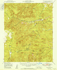
1949 Map of Camp Wood
USGS Topo · Published 1949About this map
The high plateau and canyon country of the Prescott National Forest are defined here by a network of isolated ranches and forest service outposts in the years following World War II. Cattle operations are the primary footprint on this landscape, with family-named holdings like the Yolo Ranch, Seven Up Ranch, and Triangle HC Ranch scattered across the drainages. The settlement of Camp Wood serves as a central point, supported by the Ranger Guard Sta and the nearby Walnut Cr Ranger Sta to the north.
Find a feature on this map
68 named features on this map. Tap any name to fly to it.
Don’t see what you’re looking for? This feature index may not catch every label — zoom into the map to look around manually.
Map Details
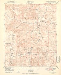
Editions of this 1949 Camp Wood Map
2 editions found
Other maps of this area

1886 · Diamond Creek
USGS Topo · 1:250,000

1886 · Chino
USGS Topo · 1:250,000

1887 · Prescott
USGS Topo · 1:250,000

1891 · Chino
USGS Topo · 1:250,000

1892 · Diamond Creek
USGS Topo · 1:250,000

1892 · Prescott
USGS Topo · 1:250,000

1923 · Signal
USGS Topo · 1:250,000

1942 · Signal
USGS Topo · 1:250,000

1945 · Bagdad
USGS Topo · 1:62,500

1947 · Simmons
USGS Topo · 1:62,500