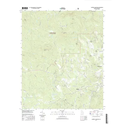
2017 Map of Campbell Mountain
USGS Topo · Published 2017About this map
The Chattahoochee National Forest dominates the terrain northwest of Dahlonega, where the high ridges of Lumpkin Ridge and Whissenhunt Mtn overlook a complex network of creeks. This modern survey shows how the landscape is defined by the headwaters of the Etowah River and its numerous tributaries, such as Nimblewill Cr and Cane Cr. The map captures a mix of public forest land and established rural settlements like Buckhorn Tavern, located near the southern border.
Find a feature on this map
137 named features on this map. Tap any name to fly to it.
Don’t see what you’re looking for? This feature index may not catch every label — zoom into the map to look around manually.
Map Details
Editions of this 2017 Campbell Mountain Map
This is the sole edition of this map. No revisions or reprints were ever made.
Other maps of this area

1886 · Dahlonega
USGS Topo · 1:125,000

1888 · Ellijay
USGS Topo · 1:125,000

1890 · Suwanee
USGS Topo · 1:125,000

1891 · Gainesville
USGS Topo · 1:125,000

1892 · Dahlonega
USGS Topo · 1:125,000

1892 · Ellijay
USGS Topo · 1:125,000

1894 · Suwanee
USGS Topo · 1:125,000

1896 · Dahlonega
USGS Topo · 1:125,000

1898 · Ellijay
USGS Topo · 1:125,000

1903 · Dahlonega
USGS Topo · 1:125,000