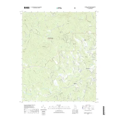
2020 Map of Campbell Mountain
USGS Topo · Published 2020About this map
Chattahoochee National Forest encompasses the western and northern portions of this landscape, where the headwaters of the Etowah River begin their southward descent. The terrain is defined by significant ridges and peaks, including Lumpkin Ridge, Black Mountain, and Campbell Mountain. These highlands are navigated by an extensive network of primitive paths and OHV routes such as the Double Bridges Ohv Trail and No-Tell Trail. To the east, the geography transitions toward the community of Dahlonega and the Cane Creek valley, where Cane Creek Falls and Clay Creek Falls mark the sharp drops in elevation. Local history is anchored by Davis Chapel and the nearby Davis Chapel Cemetery, while the presence of Buckhorn Tavern and Jay Bridge indicates historical crossing points and gathering spots. The map also detail the Lumpkin County-Wimpys Airport and several watershed lakes, illustrating the area's modern infrastructure alongside its traditional rural character.
Find a feature on this map
162 named features on this map. Tap any name to fly to it.
Don’t see what you’re looking for? This feature index may not catch every label — zoom into the map to look around manually.
Map Details
Editions of this 2020 Campbell Mountain Map
This is the sole edition of this map. No revisions or reprints were ever made.
Other maps of this area

1886 · Dahlonega
USGS Topo · 1:125,000

1888 · Ellijay
USGS Topo · 1:125,000

1890 · Suwanee
USGS Topo · 1:125,000

1891 · Gainesville
USGS Topo · 1:125,000

1892 · Dahlonega
USGS Topo · 1:125,000

1892 · Ellijay
USGS Topo · 1:125,000

1894 · Suwanee
USGS Topo · 1:125,000

1896 · Dahlonega
USGS Topo · 1:125,000

1898 · Ellijay
USGS Topo · 1:125,000

1903 · Dahlonega
USGS Topo · 1:125,000