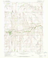
1969 Map of Campbell
USGS Topo · Published 1971About this map
Campbell serves as the primary hub of this south-central Nebraska landscape, where the Burlington Northern railroad cuts through the valley of the Little Blue River. The terrain is divided into several townships including Grant, Logan, and Harmony, reflecting the grid-based settlement pattern of the High Plains. Genealogists will find a significant concentration of burial sites surrounding the town, including Campbell Cem, St Ann Cem, Harmony Cem, and Koch Cem.
Find a feature on this map
23 named features on this map. Tap any name to fly to it.
Don’t see what you’re looking for? This feature index may not catch every label — zoom into the map to look around manually.
Map Details
Editions of this 1969 Campbell Map
This is the sole edition of this map. No revisions or reprints were ever made.
Other maps of this area

1897 · Red Cloud
USGS Topo · 1:125,000

1940 · Red Cloud
USGS Topo · 1:62,500

1942 · Red Cloud
USGS Topo · 1:62,500

1955 · Grand Island
USGS Topo · 1:250,000

1957 · Grand Island
USGS Topo · 1:250,000

1958 · Grand Island
USGS Topo · 1:250,000

1969 · Upland SE
USGS Topo · 1:24,000
1969 · Holstein
USGS Topo · 1:24,000
1969 · Roseland
USGS Topo · 1:24,000
1969 · Bladen
USGS Topo · 1:24,000