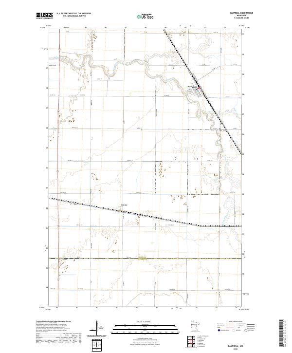
2022 Map of Campbell
USGS Topo · Published 2022About this map
Campbell serves as the primary hub of activity in this agricultural landscape where the Rabbit River meanders toward its confluence. The settlement's layout is defined by the intersection of local routes like Co Hwy 17 and Co Hwy 4, alongside the diagonal path of the regional rail line. Further south, the small village of Tenney sits along a quiet stretch of highway, illustrating the sparse but deliberate distribution of early farming communities across the Red River Valley region. The geography is characterized by the divide between Wilkin Co and Traverse Co, with the S Fork Rabbit River providing drainage for the surrounding fields. This survey documents the persistent grid of township roads, such as Twp Rd 140, which have supported the area's rural economy for generations.
Find a feature on this map
55 named features on this map. Tap any name to fly to it.
Don’t see what you’re looking for? This feature index may not catch every label — zoom into the map to look around manually.
Map Details
Editions of this 2022 Campbell Map
This is the sole edition of this map. No revisions or reprints were ever made.
Other maps of this area

1904 · Wahpeton
USGS Topo · 1:125,000

1915 · White Rock
USGS Topo · 1:62,500

1918 · White Rock
USGS Topo · 1:62,500

1951 · Wheaton
USGS Topo · 1:62,500

1951 · Campbell
USGS Topo · 1:62,500

1953 · Milbank
USGS Topo · 1:250,000

1953 · Fargo
USGS Topo · 1:250,000

1956 · Fargo
USGS Topo · 1:250,000

1958 · Milbank
USGS Topo · 1:250,000
1972 · Boisberg
USGS Topo · 1:24,000