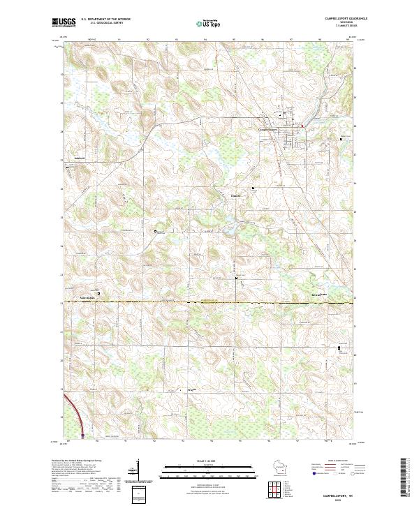
2022 Map of Campbellsport
USGS Topo · Published 2022About this map
The Br Milwaukee River and its western branch define the drainage of this Fond du Lac and Washington County landscape, centered on the village of Campbellsport. The town’s early industrial roots are visible at the Campbellsport Millpond, while surrounding smaller settlements like Ashford, Elmore, and Saint Kilian reflect the agricultural character of the region. This modern topographic record reveals a landscape deeply connected to its glacial past, evidenced by the winding path of Moraine Dr and the presence of significant wetlands such as McCullough Marsh and Wayne Marsh. Genealogists will find a high density of burial sites documenting the area's diverse community history, including Saint Martins Cem, Deutsche Bisch Cem, and Union Cem. The map traces the transition from the rolling terrain near Kewaskum to the flatter marshlands of the south, illustrating the enduring road network from Campbell Dr down to Wayne Center Dr.
Find a feature on this map
81 named features on this map. Tap any name to fly to it.
Don’t see what you’re looking for? This feature index may not catch every label — zoom into the map to look around manually.
Map Details
Editions of this 2022 Campbellsport Map
This is the sole edition of this map. No revisions or reprints were ever made.
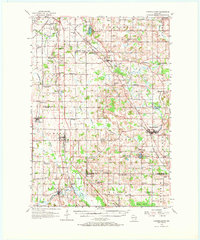
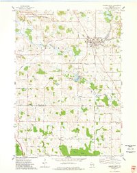
Historical Maps of Elmore Through Time
3 maps found