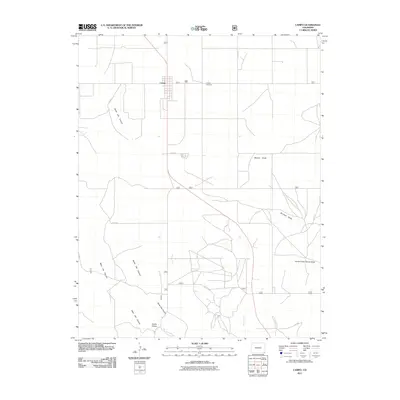
2011 Map of Campo
USGS Topo · Published 2011About this map
Campo stands as the primary hub of this high plains landscape in Baca County, characterized by a structured grid of county roads that carve through the arid terrain. The settlement is anchored by the Campo Cemetery to the east and is surrounded by a network of drainage features that define the topography of southeast Colorado. Significant geological impressions like North Ute Canyon and West Ute Canyon cut through the western portion of the map, converging near the distinctive bend of Devils Elbow along Ute Canyon Creek. To the east, the land is marked by various seasonal watercourses including Murray Draw, Burrows Draw, and Aubury Creek. This map reveals a late-period view of the area's rural organization, where livestock and agriculture are supported by a sparse but essential network of draws and creeks.
Find a feature on this map
16 named features on this map. Tap any name to fly to it.
Don’t see what you’re looking for? This feature index may not catch every label — zoom into the map to look around manually.
Map Details
Editions of this 2011 Campo Map
This is the sole edition of this map. No revisions or reprints were ever made.
Other maps of this area

1891 · Springfield
USGS Topo · 1:125,000

1892 · Vilas
USGS Topo · 1:125,000

1893 · Springfield
USGS Topo · 1:125,000

1954 · Dalhart
USGS Topo · 1:250,000

1955 · La Junta
USGS Topo · 1:250,000

1958 · La Junta
USGS Topo · 1:250,000

1958 · Dalhart
USGS Topo · 1:250,000

1962 · Dalhart
USGS Topo · 1:250,000

1968 · La Junta
USGS Topo · 1:250,000

1968 · Autograph Cliff NW
USGS Topo · 1:24,000