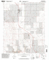
1996 Map of Campo
USGS Topo · Published 2000About this map
Comanche National Grassland dominates this Southeast Colorado landscape, where the small settlement of Campo serves as the primary hub for this corner of Baca County. The map details a transition from the structured street grid of the town—complete with a Park, Storage Bins, and Sewage Disposal Ponds—to the open, rolling terrain of the shortgrass prairie. The topography is defined by the winding paths of North Ute Canyon and West Ute Canyon, which converge near distinctive geological markers like Devils Elbow. These drainages, alongside Murray Draw and North Pickel House Draw, reveal the natural hydrological patterns crucial to the region's agricultural history. Local infrastructure is noted by a Cem northeast of town and a remote Landing Strip, illustrating the vast distances and specialized transportation needs of the High Plains.
Find a feature on this map
15 named features on this map. Tap any name to fly to it.
Don’t see what you’re looking for? This feature index may not catch every label — zoom into the map to look around manually.
Map Details
Editions of this 1996 Campo Map
This is the sole edition of this map. No revisions or reprints were ever made.
Other maps of this area

1891 · Springfield
USGS Topo · 1:125,000

1892 · Vilas
USGS Topo · 1:125,000

1893 · Springfield
USGS Topo · 1:125,000

1954 · Dalhart
USGS Topo · 1:250,000

1955 · La Junta
USGS Topo · 1:250,000

1958 · La Junta
USGS Topo · 1:250,000

1958 · Dalhart
USGS Topo · 1:250,000

1962 · Dalhart
USGS Topo · 1:250,000

1968 · La Junta
USGS Topo · 1:250,000

1968 · Autograph Cliff NW
USGS Topo · 1:24,000