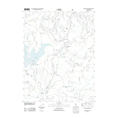
2012 Map of Camptonville
USGS Topo · Published 2012About this map
Camptonville sits at the heart of this landscape, serving as a focal point for a region defined by its hydraulic mining legacy and complex water systems. The map documents the extensive reach of the New Bullards Bar Reservoir to the west, while numerous family-named properties like the Lohman Ranch, Porter Ranch, and Bärtsch Ranch dot the surrounding ridges and canyons. The historical footprint of gold mining is evident through features such as Joubert Diggings and Badger Hill Diggings, alongside infrastructure like the Lohman Ridge Tunnel and Camptonville Tunnel. The terrain transitions from the deep cut of the Middle Yuba River along San Juan Ridge in the south to the high elevations of Alaska Peak in the northeast. This area maintains its connection to pioneer-era transport and industry through names like Freemans Crossing and the Old Toll Rd, providing a detailed view of the rural settlement patterns in the Yuba River watershed.
Find a feature on this map
94 named features on this map. Tap any name to fly to it.
Don’t see what you’re looking for? This feature index may not catch every label — zoom into the map to look around manually.
Map Details
Editions of this 2012 Camptonville Map
This is the sole edition of this map. No revisions or reprints were ever made.
Other maps of this area

1888 · Smartsville
USGS Topo · 1:125,000

1888 · Bidwell Bar
USGS Topo · 1:125,000

1891 · Bidwell Bar
USGS Topo · 1:125,000

1891 · Downieville
USGS Topo · 1:125,000

1891 · Colfax
USGS Topo · 1:125,000

1891 · Smartsville
USGS Topo · 1:125,000

1892 · Smartsville
USGS Topo · 1:125,000

1892 · Colfax
USGS Topo · 1:125,000

1893 · Bidwell Bar
USGS Topo · 1:125,000

1893 · Downieville
USGS Topo · 1:125,000