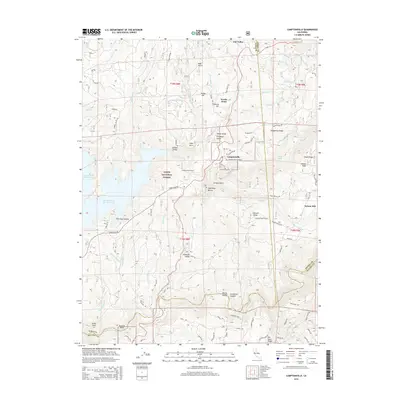
2015 Map of Camptonville
USGS Topo · Published 2015About this map
Camptonville serves as the central hub of this Gold Country landscape, situated at the intersection of Marysville Rd and Camptonville Rd. The map illustrates a region defined by steep ridges and deep canyons within the Tahoe National Forest, where the Middle Yuba River carves the southern boundary across Yuba and Nevada counties. Small communities and historical sites like Oak Valley, Youngs Hill, and Weeds Point are scattered throughout the highlands, connected by a network of winding roads such as Old Toll Rd and Henness Pass Rd.
Find a feature on this map
96 named features on this map. Tap any name to fly to it.
Don’t see what you’re looking for? This feature index may not catch every label — zoom into the map to look around manually.
Map Details
Editions of this 2015 Camptonville Map
This is the sole edition of this map. No revisions or reprints were ever made.
Other maps of this area

1888 · Smartsville
USGS Topo · 1:125,000

1888 · Bidwell Bar
USGS Topo · 1:125,000

1891 · Bidwell Bar
USGS Topo · 1:125,000

1891 · Downieville
USGS Topo · 1:125,000

1891 · Colfax
USGS Topo · 1:125,000

1891 · Smartsville
USGS Topo · 1:125,000

1892 · Smartsville
USGS Topo · 1:125,000

1892 · Colfax
USGS Topo · 1:125,000

1893 · Bidwell Bar
USGS Topo · 1:125,000

1893 · Downieville
USGS Topo · 1:125,000