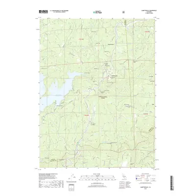
2018 Map of Camptonville
USGS Topo · Published 2018About this map
Camptonville serves as a central hub in this high-elevation landscape where Yuba, Sierra, and Nevada counties converge. The terrain is defined by the deep carving of the Middle Yuba River and the expansive reach of the New Bullards Bar Reservoir to the west. Evidence of the region’s complex engineering and mining history is visible through features like the Camptonville Tunnel and the Lohman Ridge Tunnel, which cut through the steep ridges. Within the Tahoe National Forest, small settlements like Pike and San Juan Ridge remain connected by historic routes such as Marysville Rd and the Old Toll Rd. Local heritage is anchored at the Camptonville Cem, while the rugged geography is marked by distinctive points like Alaska Peak and the curious naming of Celestial Valley.
Find a feature on this map
104 named features on this map. Tap any name to fly to it.
Don’t see what you’re looking for? This feature index may not catch every label — zoom into the map to look around manually.
Map Details
Editions of this 2018 Camptonville Map
This is the sole edition of this map. No revisions or reprints were ever made.
Other maps of this area

1888 · Smartsville
USGS Topo · 1:125,000

1888 · Bidwell Bar
USGS Topo · 1:125,000

1891 · Bidwell Bar
USGS Topo · 1:125,000

1891 · Downieville
USGS Topo · 1:125,000

1891 · Colfax
USGS Topo · 1:125,000

1891 · Smartsville
USGS Topo · 1:125,000

1892 · Smartsville
USGS Topo · 1:125,000

1892 · Colfax
USGS Topo · 1:125,000

1893 · Bidwell Bar
USGS Topo · 1:125,000

1893 · Downieville
USGS Topo · 1:125,000