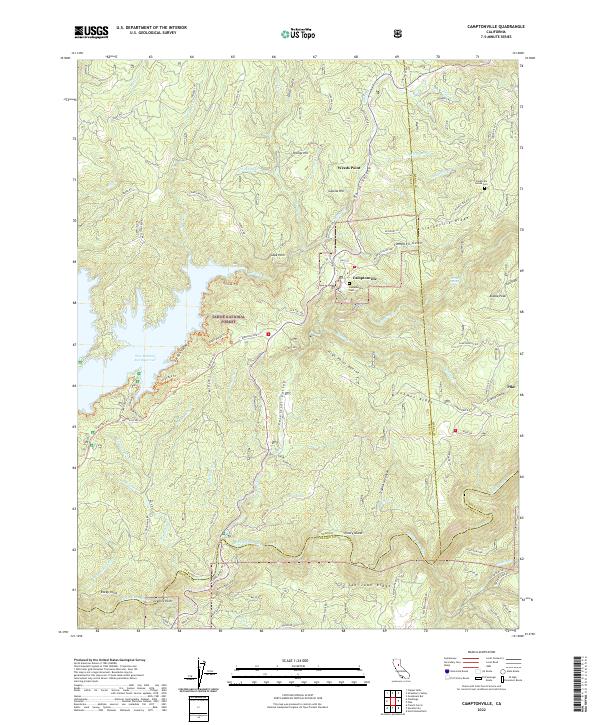
2022 Map of Camptonville
USGS Topo · Published 2022About this map
Camptonville serves as the focal point for this survey of the Gold Country's high ridges, situated where the northern Sierra foothills meet the Tahoe National Forest. The landscape is defined by deep drainages like Campbell Gulch and High Point Ravine that feed into the Middle Yuba River and the expansive New Bullards Bar Reservoir. Historic mining settlements and small communities are scattered across the timbered terrain, including Pike, Youngs Hill, and Galena Hill. Local genealogy is anchored by sites such as the Camptonville Cem and the Sleighville House Cem, which stand near the notable Sleighville Ridge. The map details a complex network of forest roads and trails, including Pike City Rd and the Henness Pass Rd, tracing the pathways of early commerce and transit through Celestial Valley and across Lohman Ridge.
Find a feature on this map
107 named features on this map. Tap any name to fly to it.
Don’t see what you’re looking for? This feature index may not catch every label — zoom into the map to look around manually.
Map Details
Editions of this 2022 Camptonville Map
This is the sole edition of this map. No revisions or reprints were ever made.
Other maps of this area

1888 · Smartsville
USGS Topo · 1:125,000

1888 · Bidwell Bar
USGS Topo · 1:125,000

1891 · Bidwell Bar
USGS Topo · 1:125,000

1891 · Downieville
USGS Topo · 1:125,000

1891 · Colfax
USGS Topo · 1:125,000

1891 · Smartsville
USGS Topo · 1:125,000

1892 · Smartsville
USGS Topo · 1:125,000

1892 · Colfax
USGS Topo · 1:125,000

1893 · Bidwell Bar
USGS Topo · 1:125,000

1893 · Downieville
USGS Topo · 1:125,000