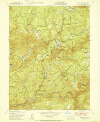
1950 Map of Camptonville
USGS Topo · Published 1950About this map
Camptonville serves as the focal point of this 1950 survey, reflecting the remote mining and ranching heritage of the Tahoe National Forest. The landscape is a network of deep drainages and ridges, with the Yuba River forming a prominent southern border near Freemans Crossing. Evidence of the region's hydraulic mining history is preserved through labels like Joubert Diggings and Diggings, while the presence of the Bullards Bar Reservoir indicates the mid-century infrastructure developments for water storage and power.
Find a feature on this map
78 named features on this map. Tap any name to fly to it.
Don’t see what you’re looking for? This feature index may not catch every label — zoom into the map to look around manually.
Map Details
Editions of this 1950 Camptonville Map
This is the sole edition of this map. No revisions or reprints were ever made.
Other maps of this area

1888 · Smartsville
USGS Topo · 1:125,000

1888 · Bidwell Bar
USGS Topo · 1:125,000

1891 · Bidwell Bar
USGS Topo · 1:125,000

1891 · Downieville
USGS Topo · 1:125,000

1891 · Colfax
USGS Topo · 1:125,000

1891 · Smartsville
USGS Topo · 1:125,000

1892 · Smartsville
USGS Topo · 1:125,000

1892 · Colfax
USGS Topo · 1:125,000

1893 · Bidwell Bar
USGS Topo · 1:125,000

1893 · Downieville
USGS Topo · 1:125,000