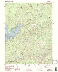
1995 Map of Camptonville
USGS Topo · Published 1995About this map
Camptonville serves as the focal point of this mid-1990s landscape, positioned on the western edge of the Tahoe National Forest. The map documents a rugged Sierra Nevada region defined by the meeting of Yuba and Sierra counties, where the deep blue expanse of the New Bullards Bar Reservoir dominates the western topography. The area retains a distinct frontier character, evidenced by numerous named ranch sites like Lohman Ranch and Wayman Ranch, and historic crossings such as Freemans Crossing on the Middle Yuba River.
Find a feature on this map
68 named features on this map. Tap any name to fly to it.
Don’t see what you’re looking for? This feature index may not catch every label — zoom into the map to look around manually.
Map Details
Editions of this 1995 Camptonville Map
This is the sole edition of this map. No revisions or reprints were ever made.
Other maps of this area

1888 · Smartsville
USGS Topo · 1:125,000

1888 · Bidwell Bar
USGS Topo · 1:125,000

1891 · Bidwell Bar
USGS Topo · 1:125,000

1891 · Downieville
USGS Topo · 1:125,000

1891 · Colfax
USGS Topo · 1:125,000

1891 · Smartsville
USGS Topo · 1:125,000

1892 · Smartsville
USGS Topo · 1:125,000

1892 · Colfax
USGS Topo · 1:125,000

1893 · Bidwell Bar
USGS Topo · 1:125,000

1893 · Downieville
USGS Topo · 1:125,000