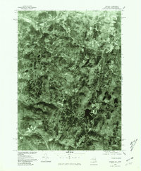
1975 Map of Canaan
USGS Topo · Published 1981About this map
Canaan and the surrounding Columbia County landscape appear here in an orthophotomap produced from 1975 aerial photography. This specialized format, published by the Geological Survey in cooperation with the Massachusetts Department of Public Works, provides a photographic record of the terrain rather than traditional topographic contours. The settlement of New Lebanon and the smaller village of West Lebanon are visible along the valley corridor defined by Kinderhook Creek in the northern portion of the sheet. Further south, the rural character of the region is evident near the hamlet of Flatbrook and the waters of Queechy Lake. This 1970s perspective captures the established road networks and agricultural patterns before late-century development altered the rural footprint of these eastern New York communities.
Find a feature on this map
6 named features on this map. Tap any name to fly to it.
Don’t see what you’re looking for? This feature index may not catch every label — zoom into the map to look around manually.
Map Details
Editions of this 1975 Canaan Map
This is the sole edition of this map. No revisions or reprints were ever made.
Other maps of this area

1888 · Berlin
USGS Topo · 1:62,500

1888 · Pittsfield
USGS Topo · 1:62,500

1890 · Pittsfield
USGS Topo · 1:62,500

1890 · Berlin
USGS Topo · 1:62,500

1893 · Troy
USGS Topo · 1:62,500

1893 · Pittsfield
USGS Topo · 1:62,500

1894 · Berlin
USGS Topo · 1:62,500

1894 · Pittsfield
USGS Topo · 1:62,500

1895 · Troy
USGS Topo · 1:62,500

1897 · Pittsfield
USGS Topo · 1:62,500