
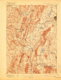
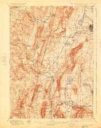
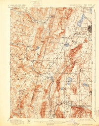
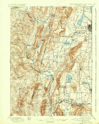
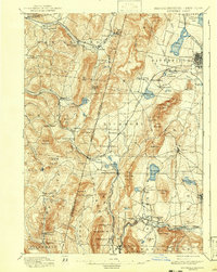
1897 Map of Pittsfield
USGS Topo · Published 1897About this map
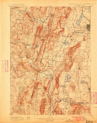
Lebanon Springs and the surrounding borderlands of Massachusetts and New York reveal a late 19th-century landscape defined by early industry and communal settlements. The map highlights significant Shaker communities, including Canaan Shakers, Shaker Village, and Mt Lebanon, marking the cultural footprint of these societies at their height. Industry is evident at Richmond Furnace and along the busy rail corridors of the Boston and Albany Railroad and the New York New Haven and Hartford. Water resources like Lake Onota, Pontoosuc Lake, and the Stockbridge Bowl are prominently featured, while the steep grades of Lenox Mountain and Perry Peak separate the residential centers of Pittsfield and Lenox from the rural valleys of Canaan. This survey documents a critical period when heavy rail and local milling operations dictated the growth of these Berkshire and Columbia County townships.
Find a feature on this map
109 named features on this map. Tap any name to fly to it.
Don’t see what you’re looking for? This feature index may not catch every label — zoom into the map to look around manually.
Map Details
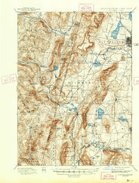
Editions of this 1897 Pittsfield Map
11 editions found
1897 edition
15.8 x 19.9 inches
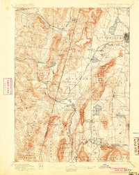
1900 edition
15.7 x 19.9 inches
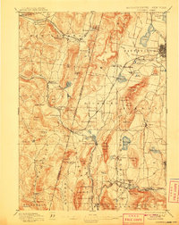
1905 edition
15.7 x 19.8 inches
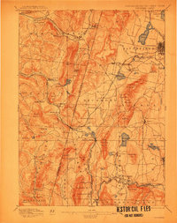
1908 edition
15.8 x 19.9 inches
1912 edition
15.7 x 20 inches
1919 edition
15.8 x 20.4 inches
1925 edition
15.8 x 19.9 inches
1931 edition
15.7 x 19.9 inches
1937 edition
15.8 x 19.8 inches
1943 edition
15.8 x 19.8 inches
1943 edition
15.8 x 20.8 inches
Other maps of this area

1885 · Sheffield
USGS Topo · 1:62,500

1886 · Greylock
USGS Topo · 1:62,500

1886 · Becket
USGS Topo · 1:62,500

1888 · Sheffield
USGS Topo · 1:62,500

1888 · Becket
USGS Topo · 1:62,500

1888 · Berlin
USGS Topo · 1:62,500

1888 · Sandisfield
USGS Topo · 1:62,500

1888 · Pittsfield
USGS Topo · 1:62,500

1890 · Pittsfield
USGS Topo · 1:62,500

1890 · Berlin
USGS Topo · 1:62,500