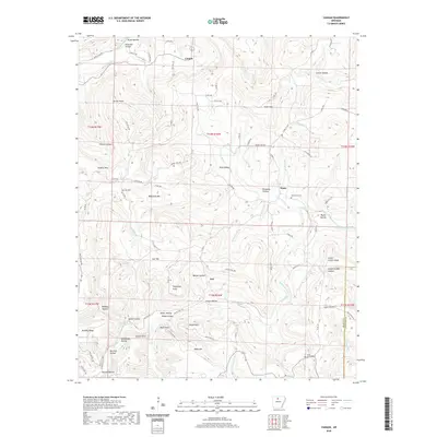
2020 Map of Canaan
USGS Topo · Published 2020About this map
The Middle Fork Little Red River carves through the Ozark Plateau in this section of Searcy County, anchoring a landscape defined by deep hollows and prominent summits. Small rural settlements like Canaan and Kay are connected by a network of winding roads, including State Hwy 333 and Searcy 169 Hwy, which follow the natural contours of the terrain. Family names and local history are etched into the geography through features like Bohannon Mtn, Bryan Hollow, and Green Griffin Knob. Genealogists will find the locations of established burial grounds such as Oak Hill Cem, Thompson Cem, and Shady Grove Cem invaluable for tracing local lineages. The drainage patterns of Little Red Cr and N Castleberry Cr illustrate the complex watershed that has historically dictated the settlement and agricultural patterns of this upland region.
Find a feature on this map
95 named features on this map. Tap any name to fly to it.
Don’t see what you’re looking for? This feature index may not catch every label — zoom into the map to look around manually.
Map Details
Editions of this 2020 Canaan Map
This is the sole edition of this map. No revisions or reprints were ever made.
Other maps of this area

1879 · Washington
USGS Topo · 1:62,500

1887 · Smyrna
USGS Topo · 1:62,500

1889 · Marshall #3
USGS Topo · 1:62,500

1892 · Marshall
USGS Topo · 1:125,000

1894 · Marshall
USGS Topo · 1:125,000

1901 · Marshall
USGS Topo · 1:125,000

1939 · Snowball
USGS Topo · 1:62,500

1940 · Smyrna
USGS Topo · 1:62,500

1941 · Snowball
USGS Topo · 1:62,500

1942 · Snowball
USGS Topo · 1:62,500