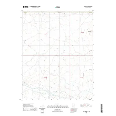
2020 Map of Canal Creek
USGS Topo · Published 2020About this map
The San Juan River flows across the southern portion of this landscape, carving a wide path through the high desert of the Four Corners region. This 2020 survey illustrates the remote borderlands between New Mexico and Colorado, where the San Juan County line meets Montezuma County. The terrain is marked by significant geological landmarks such as Standing Rock in the northeast and Volcano Peak further south. Water management and drainage are defined by the Shiprock Wash and Malpais Arroyo, which feed into the primary river valley. A network of service roads, including Pipe Line Rd and Indian Svc Rte 5030, provides the only modern infrastructure through the vast expanses of t32n r19w and surrounding townships, highlighting the intersection of industrial access and tribal land management in the Shiprock Agency area.
Find a feature on this map
16 named features on this map. Tap any name to fly to it.
Don’t see what you’re looking for? This feature index may not catch every label — zoom into the map to look around manually.
Map Details
Editions of this 2020 Canal Creek Map
This is the sole edition of this map. No revisions or reprints were ever made.
Other maps of this area

1889 · Chaco
USGS Topo · 1:250,000

1892 · Chaco
USGS Topo · 1:250,000

1934 · Chimney Rock
USGS Topo · 1:62,500

1934 · Rattlesnake
USGS Topo · 1:62,500

1936 · Chimney Rock
USGS Topo · 1:62,500

1937 · Rattlesnake
USGS Topo · 1:62,500

1954 · Shiprock
USGS Topo · 1:250,000

1956 · Cortez
USGS Topo · 1:250,000

1958 · Cortez
USGS Topo · 1:250,000

1958 · Shiprock
USGS Topo · 1:250,000