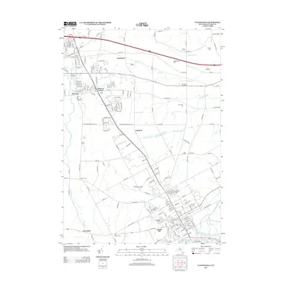
2013 Map of Canandaigua
USGS Topo · Published 2013About this map
Canandaigua and the northern reaches of its namesake lake anchor this region in Ontario County, where modern infrastructure meets long-standing agricultural roots. The landscape is defined by the drainage of Canandaigua Outlet and numerous small waterways like Padelford Brook and Sucker Brook that flow through the glacial topography of Buttermilk Hill and Young Hill. The map reflects a community with deep lineage, preserving numerous historical burial grounds such as Hathaway Cem, S Farmington Cem, and Sand Hill Cem.
Find a feature on this map
182 named features on this map. Tap any name to fly to it.
Don’t see what you’re looking for? This feature index may not catch every label — zoom into the map to look around manually.
Map Details
Editions of this 2013 Canandaigua Map
This is the sole edition of this map. No revisions or reprints were ever made.
Other maps of this area

1899 · Palmyra
USGS Topo · 1:62,500

1900 · Macedon
USGS Topo · 1:62,500

1900 · Canandaigua
USGS Topo · 1:62,500

1902 · Phelps
USGS Topo · 1:62,500

1902 · Palmyra
USGS Topo · 1:62,500

1903 · Canandaigua
USGS Topo · 1:62,500

1932 · Fairport
USGS Topo · 1:24,000

1934 · Fairport
USGS Topo · 1:24,000
1942 · Victor
USGS Topo · 1:31,680

1942 · Canandaigua
USGS Topo · 1:31,680