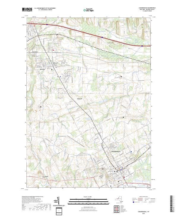
2023 Map of Canandaigua
USGS Topo · Published 2023About this map
The Ontario County Courthouse stands at the center of Canandaigua, the focal point of a landscape where urban development meets the persistent wetlands of the Finger Lakes region. The terrain is marked by distinctive elevations like Arsenal Hill and Young Hill, while the drainage patterns of Sucker Brook and the Canandaigua Outlet dictate the layout of local infrastructure. To the north and west, smaller settlements such as Mertensia, Centerfield, and Hathaway Corners preserve a more dispersed rural character, connected by a dense network of roads like Rochester Rd and Collett Rd.
Find a feature on this map
145 named features on this map. Tap any name to fly to it.
Don’t see what you’re looking for? This feature index may not catch every label — zoom into the map to look around manually.
Map Details
Editions of this 2023 Canandaigua Map
This is the sole edition of this map. No revisions or reprints were ever made.
Other maps of this area

1899 · Palmyra
USGS Topo · 1:62,500

1900 · Macedon
USGS Topo · 1:62,500

1900 · Canandaigua
USGS Topo · 1:62,500

1902 · Phelps
USGS Topo · 1:62,500

1902 · Palmyra
USGS Topo · 1:62,500

1903 · Canandaigua
USGS Topo · 1:62,500

1932 · Fairport
USGS Topo · 1:24,000

1934 · Fairport
USGS Topo · 1:24,000
1942 · Victor
USGS Topo · 1:31,680

1942 · Canandaigua
USGS Topo · 1:31,680