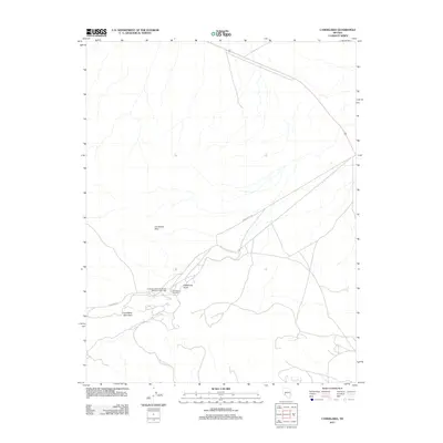
2011 Map of Candelaria
USGS Topo · Published 2011About this map
Candelaria Mountain and the Candelaria Hills dominate this high-desert landscape in Esmeralda County. The industrial heritage of the area is centered on the Candelaria Water Works and Milling Company Mill, a significant landmark connected to the local mining history that defined this region. The map details the intricate road network serving these remote sites, including Candelaria Rd and Pump Hse Rd, which wind through the topography toward Pickhandle Gulch. For genealogists and local historians, the Candelaria Cemetery provides a specific point of interest, anchoring the human history of this mining district amidst the vast terrain. The sparse distribution of named features highlights the specialized, resource-driven nature of settlement in this part of Nevada.
Find a feature on this map
8 named features on this map. Tap any name to fly to it.
Don’t see what you’re looking for? This feature index may not catch every label — zoom into the map to look around manually.
Map Details
Editions of this 2011 Candelaria Map
This is the sole edition of this map. No revisions or reprints were ever made.
Other maps of this area

1907 · Tonopah
USGS Topo · 1:250,000

1908 · Tonopah
USGS Topo · 1:250,000

1909 · Hawthorne
USGS Topo · 1:250,000

1911 · Hawthorne
USGS Topo · 1:250,000

1915 · Hawthorne
USGS Topo · 1:250,000

1948 · Walker Lake
USGS Topo · 1:250,000

1956 · Tonopah
USGS Topo · 1:250,000

1957 · Walker Lake
USGS Topo · 1:250,000

1959 · Tonopah
USGS Topo · 1:250,000

1962 · Walker Lake
USGS Topo · 1:250,000