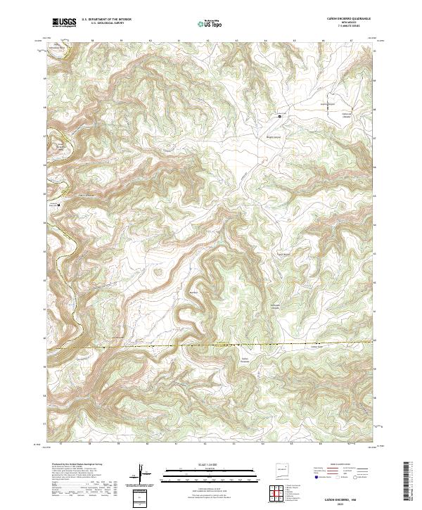
2023 Map of Canon Encierro
USGS Topo · Published 2023About this map
The Canadian River carves a dramatic path through this high desert landscape, creating the distinct looping formations of Upper Horseshoe Bend and Lower Horseshoe Bend. This territory along the borders of Harding, Mora, and San Miguel counties is defined by a dense network of drainages and named canyons, including Cañon Encierro and Lucero Canyon. Historically significant burial sites like Armenta Plaza Cem and Calvert Cem are tucked into the terrain, offering essential coordinates for genealogists studying the early ranching families of the region.
Find a feature on this map
34 named features on this map. Tap any name to fly to it.
Don’t see what you’re looking for? This feature index may not catch every label — zoom into the map to look around manually.
Map Details
Editions of this 2023 Canon Encierro Map
This is the sole edition of this map. No revisions or reprints were ever made.
Other maps of this area

1954 · Santa Fe
USGS Topo · 1:250,000

1958 · Santa Fe
USGS Topo · 1:250,000

1971 · Beaver Canyon
USGS Topo · 1:24,000

1971 · Alamito
USGS Topo · 1:24,000

1971 · Canon Las Cuevas
USGS Topo · 1:24,000

1971 · Canon Encierro
USGS Topo · 1:24,000

1972 · Arroyo Alamocito
USGS Topo · 1:24,000

1972 · Montoya Point
USGS Topo · 1:24,000
1972 · Sabinoso
USGS Topo · 1:24,000
1974 · Roy
USGS Topo · 1:24,000