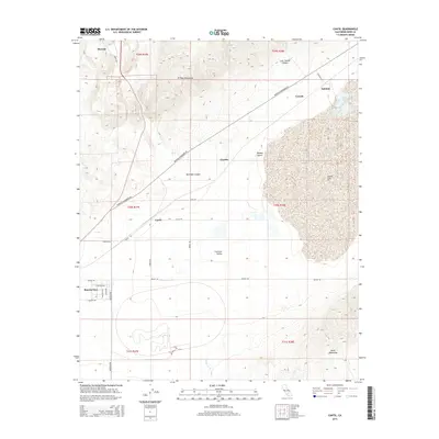
2015 Map of Cantil
USGS Topo · Published 2015About this map
Koehn Lake dominates the eastern basin of this Kern County landscape, serving as the terminus for drainage from the surrounding high ground. The terrain is defined by the sharp rise of the El Paso Mountains to the north and the Rand Mountains to the south, with the Fremont Valley spreading between them. Settlement patterns follow the low-lying basins and transportation corridors, with small communities like Cantil and Saltdale situated near the lake's edge and along the rail line. To the northwest, the map captures the transition into the Mojave Desert floor, where Red Rock Canyon and Last Chance Canyon carve through the foothills near Ricardo. This 2015 edition provides a modern topographic record of these remote high-desert outposts, documenting the established grid of local roads like Neuralia Rd and Munsey Rd that service the Rancho Seco area.
Find a feature on this map
34 named features on this map. Tap any name to fly to it.
Don’t see what you’re looking for? This feature index may not catch every label — zoom into the map to look around manually.
Map Details
Editions of this 2015 Cantil Map
This is the sole edition of this map. No revisions or reprints were ever made.
Other maps of this area

1915 · Searles Lake
USGS Topo · 1:250,000

1915 · Mojave
USGS Topo · 1:125,000

1943 · Cross Mountain
USGS Topo · 1:62,500

1943 · Saltdale
USGS Topo · 1:62,500

1943 · Castle Butte
USGS Topo · 1:62,500

1943 · Mojave
USGS Topo · 1:62,500

1947 · Castle Butte
USGS Topo · 1:50,000

1947 · Trona
USGS Topo · 1:250,000

1948 · Trona
USGS Topo · 1:250,000

1948 · Bakersfield
USGS Topo · 1:250,000