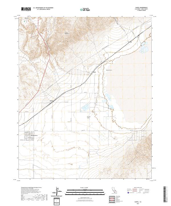
2021 Map of Cantil
USGS Topo · Published 2021About this map
El Paso Mountains and the Rand Mountains frame a wide desert basin where the Fremont Valley meets the edge of the Mojave Desert. This 2021 survey shows a landscape defined by its corridor of transportation and small, specialized settlements. The Midland Trl and various utility-oriented roads connect the sparse outposts of Cantil, Gypsite, and Rancho Seco. The presence of labels like Gypsite suggests the region's mineral history, while the grid of roads such as Quartz Rd and Cinnabar Rd near Rancho Seco reflects a late-century shift toward rural residential plotting in the high desert. To the north, the dramatic topography of Red Rock Canyon and Last Chance Canyon cuts through the uplands, providing a sharp contrast to the flat valley floor where Cache Cr occasionally drains.
Find a feature on this map
35 named features on this map. Tap any name to fly to it.
Don’t see what you’re looking for? This feature index may not catch every label — zoom into the map to look around manually.
Map Details
Editions of this 2021 Cantil Map
This is the sole edition of this map. No revisions or reprints were ever made.
Other maps of this area

1915 · Searles Lake
USGS Topo · 1:250,000

1915 · Mojave
USGS Topo · 1:125,000

1943 · Cross Mountain
USGS Topo · 1:62,500

1943 · Saltdale
USGS Topo · 1:62,500

1943 · Castle Butte
USGS Topo · 1:62,500

1943 · Mojave
USGS Topo · 1:62,500

1947 · Castle Butte
USGS Topo · 1:50,000

1947 · Trona
USGS Topo · 1:250,000

1948 · Trona
USGS Topo · 1:250,000

1948 · Bakersfield
USGS Topo · 1:250,000