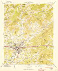
1941 Map of Canton
USGS Topo · Published 1956About this map
The industrial and residential growth of Canton centers on the curves of the Pigeon River and the critical Southern railway line in this mid-century portrait of Haywood County. The mill town's footprint includes the employee housing of Fiberville and the expansion into West Canton, showing a dense urban core transitioning abruptly into the steep elevations of Newfound Mountain. Water management for the growing municipality is evidenced by the Canton Reservoir and a smaller Reservoir near Beaverdam Creek, reflecting the infrastructure needed to support both the population and local industry. To the north and south, the landscape is defined by traditional rural mountain communities such as Sandy Mush and Leicester. Small family churches and schools like Browns Chapel, Beaverdam Sch, and Ridgeway Ch are scattered throughout the numerous coves, marking the social centers of these high-elevation settlements.
Find a feature on this map
92 named features on this map. Tap any name to fly to it.
Don’t see what you’re looking for? This feature index may not catch every label — zoom into the map to look around manually.
Map Details
Editions of this 1941 Canton Map
This is the sole edition of this map. No revisions or reprints were ever made.
Other maps of this area

1894 · Asheville
USGS Topo · 1:125,000

1901 · Asheville
USGS Topo · 1:125,000

1905 · Pisgah
USGS Topo · 1:125,000

1906 · Pisgah
USGS Topo · 1:125,000

1935 · Cruso
USGS Topo · 1:24,000

1935 · Waynesville
USGS Topo · 1:24,000

1935 · Canton
USGS Topo · 1:24,000

1935 · Clyde
USGS Topo · 1:24,000

1936 · Sandymush
USGS Topo · 1:24,000

1936 · Enka
USGS Topo · 1:24,000