
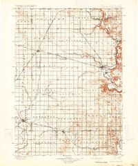
1900 Map of Canton
USGS Topo · Published 1900About this map
The Big Sioux River carves the eastern boundary of this South Dakota landscape, defining the state line with Iowa at the turn of the century. Surveyed by Jno. H. Renshawe and his team in the late 1890s, the terrain is a grid of agricultural townships like Springdale and Delaware, interconnected by a dense network of competing rail lines. The Chicago Milwaukee and St. Paul R.R. and the Chicago and Northwestern R.R. facilitate the growth of early prairie hubs such as Canton and Lennox. Smaller settlements like Worthing, Harrisburg, and Beresford appear as established rail stops during this era of rapid expansion. To the west, the Vermilion River snakes through Riverside, while numerous local watercourses such as Beaver Creek and Saddle Creek dictate the placement of early farms and pioneer homesteads across Lincoln, Turner, and Clay counties.
Find a feature on this map
96 named features on this map. Tap any name to fly to it.
Don’t see what you’re looking for? This feature index may not catch every label — zoom into the map to look around manually.
Map Details
Editions of this 1900 Canton Map
2 editions found
Other maps of this area

1897 · Canton
USGS Topo · 1:125,000

1898 · Parker
USGS Topo · 1:125,000

1898 · Elk Point
USGS Topo · 1:125,000

1901 · Elk Point
USGS Topo · 1:125,000

1907 · Elk Point
USGS Topo · 1:125,000

1955 · Sioux City
USGS Topo · 1:250,000

1955 · Sioux Falls
USGS Topo · 1:250,000

1958 · Sioux City
USGS Topo · 1:250,000

1958 · Sioux Falls
USGS Topo · 1:250,000

1959 · Sioux City
USGS Topo · 1:250,000