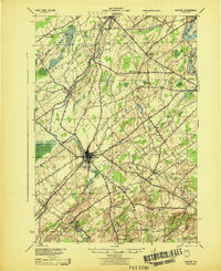
1944 Map of Canton
USGS Topo · Published 1944About this map
Canton serves as the focal point of this St. Lawrence County survey, situated at the confluence of several early 20th-century transportation routes. The landscape is defined by the parallel courses of the Grass River and the Raquette River, which supported numerous small riverside communities. This mid-century revision, updated by the Army Map Service using 1941 aerial photography, shows the established rail corridors of the Rutland and New York Central lines before the major highway expansions of the later century.
Find a feature on this map
37 named features on this map. Tap any name to fly to it.
Don’t see what you’re looking for? This feature index may not catch every label — zoom into the map to look around manually.
Map Details
Editions of this 1944 Canton Map
This is the sole edition of this map. No revisions or reprints were ever made.
Other maps of this area

1904 · Lisbon
USGS Topo · 1:48,000

1904 · Ogdensburg
USGS Topo · 1:62,500

1905 · Waddington
USGS Topo · 1:62,500

1905 · Ogdensburg
USGS Topo · 1:62,500

1906 · Red Mills
USGS Topo · 1:62,500

1906 · Massena
USGS Topo · 1:62,500

1907 · Massena
USGS Topo · 1:62,500

1908 · Potsdam
USGS Topo · 1:62,500

1910 · Canton
USGS Topo · 1:62,500

1911 · Canton
USGS Topo · 1:62,500