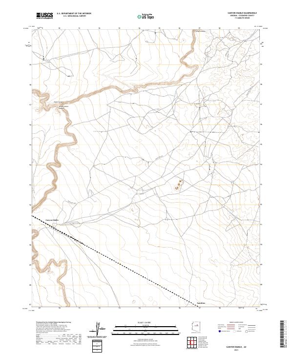
2021 Map of Canyon Diablo
USGS Topo · Published 2021About this map
Canyon Diablo cuts a deep, winding path through this high desert plateau, its course marking the central drainage of a landscape defined by dramatic geological breaks. The terrain is further etched by Padre Canyon and Yellow Jacket Canyon in the northwest, which feed toward the primary gorge. The arid surface is crossed by a network of unimproved trails and the established path of Indian Rte 6930, which provides access across the various townships and ranges. Near the southern edge of the quadrangle, the small settlement of Sunshine sits along a primary east-west transportation corridor. This 2021 survey illustrates the continued isolation of the region, where the primary infrastructure consists of remote tracks and the deep natural scars of the canyons rather than dense residential development.
Find a feature on this map
14 named features on this map. Tap any name to fly to it.
Don’t see what you’re looking for? This feature index may not catch every label — zoom into the map to look around manually.
Map Details
Editions of this 2021 Canyon Diablo Map
This is the sole edition of this map. No revisions or reprints were ever made.
Other maps of this area

1883 · Tusayan
USGS Topo · 1:250,000

1886 · Tusayan
USGS Topo · 1:250,000

1886 · San Francisco Mtns
USGS Topo · 1:250,000

1891 · San Francisco Mtns
USGS Topo · 1:250,000

1894 · San Francisco Mtns
USGS Topo · 1:250,000

1899 · San Francisco Mtns
USGS Topo · 1:250,000

1947 · Flagstaff
USGS Topo · 1:250,000

1954 · Flagstaff
USGS Topo · 1:250,000

1955 · Winslow 2 SW
USGS Topo · 1:24,000

1955 · Leupp
USGS Topo · 1:62,500