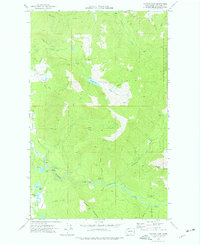
1972 Map of Canyon Lake
USGS Topo · Published 1976About this map
Canyon Lake Road winds through the northwestern reaches of the Mt Baker National Forest, providing access to the high-elevation Canyon Lake and its surrounding drainage basin. The landscape is defined by its industrial and hydraulic infrastructure from the early 1970s, including a Diversion Dam and Gaging Station on the Middle Fork Nooksack River. An Aqueduct system is traced southward, reflecting the area's importance for water management and resource extraction, punctuated by several Borrow Pits and timber-access paths like the Pack Trail. To the south, Mosquito Lake and Jorgensen Lake sit in lower terrain, while peaks such as Slide Mtn and Stewart Peak dominate the skyline. Numerous named drainages, including Racehorse Creek and Clearwater Creek, emphasize the complex hydrology of this part of Whatcom County during a period of active forest management.
Find a feature on this map
34 named features on this map. Tap any name to fly to it.
Don’t see what you’re looking for? This feature index may not catch every label — zoom into the map to look around manually.
Map Details
Editions of this 1972 Canyon Lake Map
2 editions found
Other maps of this area

1909 · Mt Baker
USGS Topo · 1:192,000

1915 · Mt. Baker
USGS Topo · 1:250,000

1919 · Van Zandt
USGS Topo · 1:62,500

1921 · Wickersham
USGS Topo · 1:62,500

1951 · Wickersham
USGS Topo · 1:62,500

1951 · Van Zandt
USGS Topo · 1:62,500

1952 · Mt. Baker
USGS Topo · 1:62,500

1952 · Hamilton
USGS Topo · 1:62,500

1955 · Concrete
USGS Topo · 1:250,000

1957 · Victoria
USGS Topo · 1:250,000