
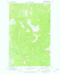
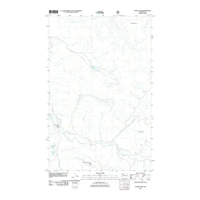
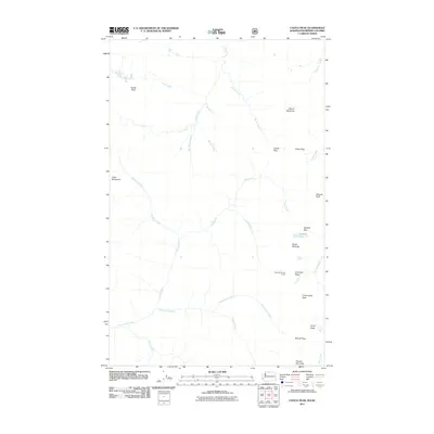
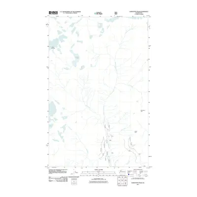
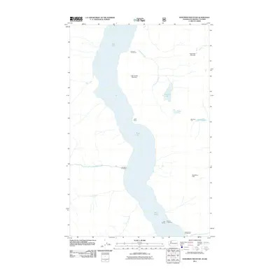
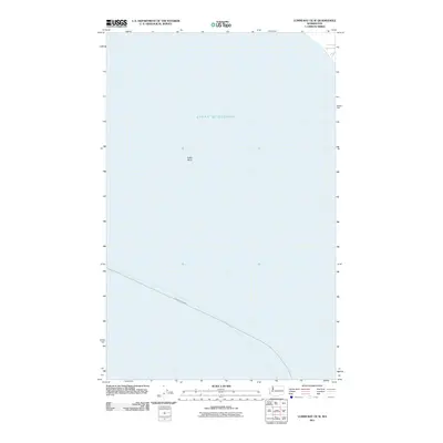
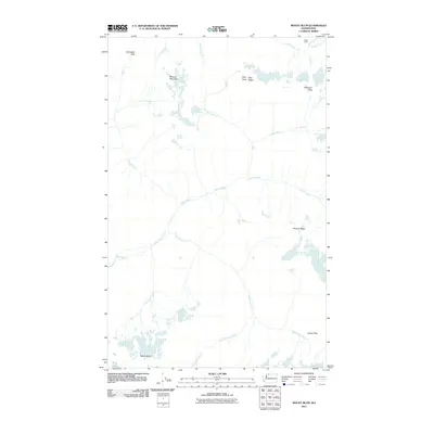
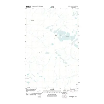
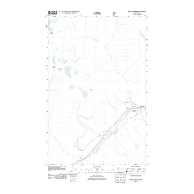
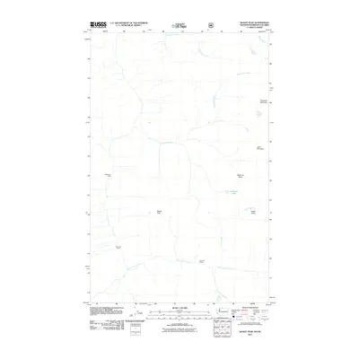
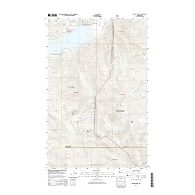
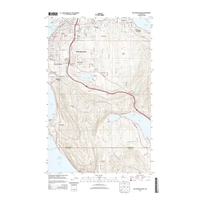
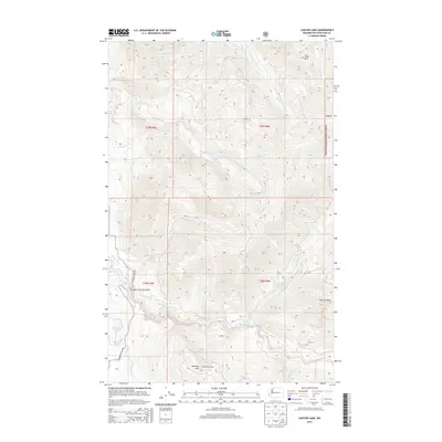
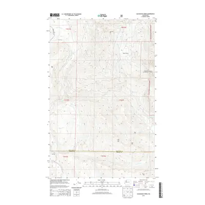
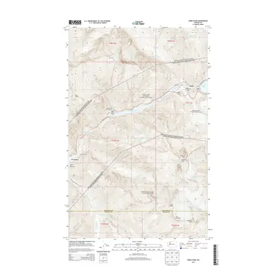
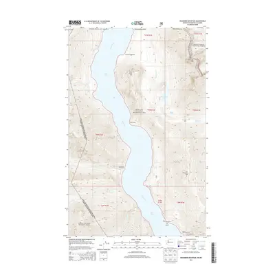
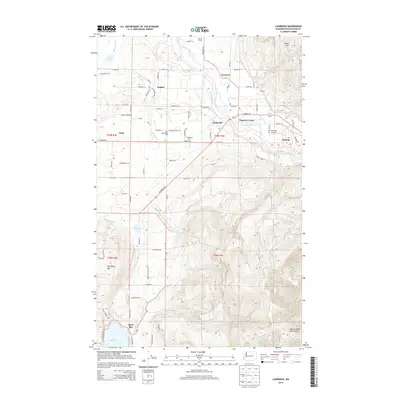
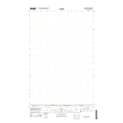
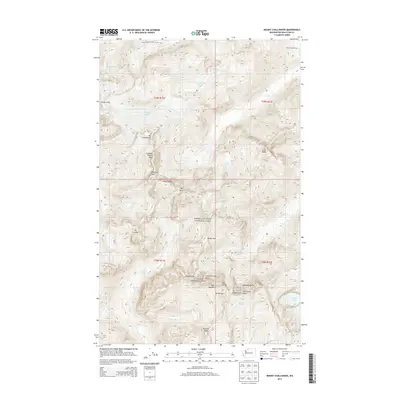
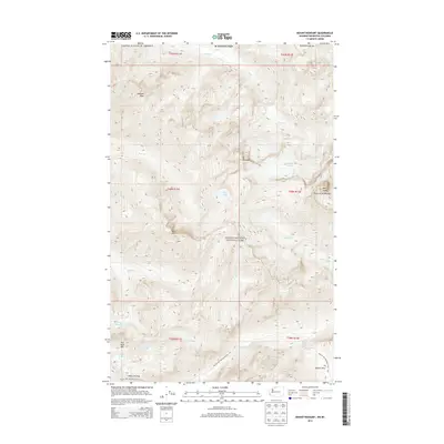
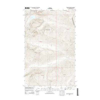
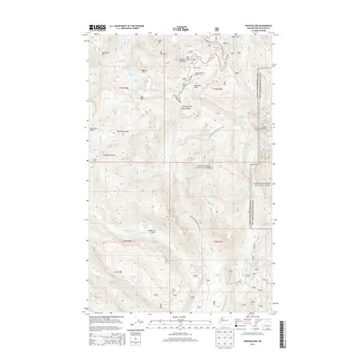
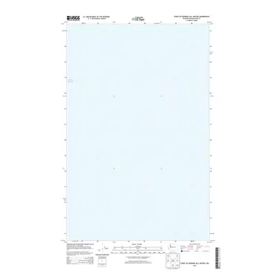
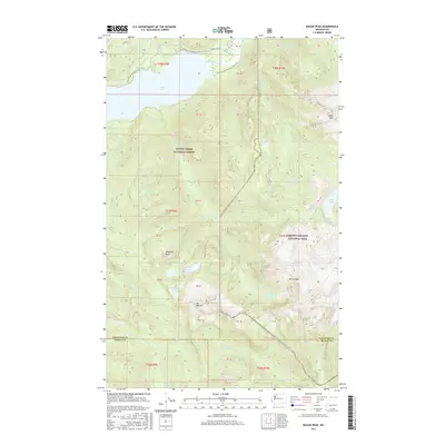
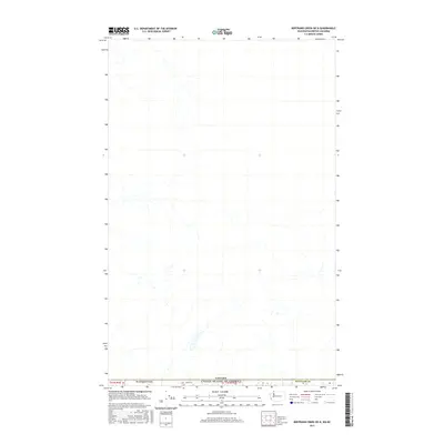
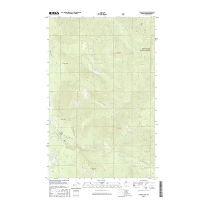
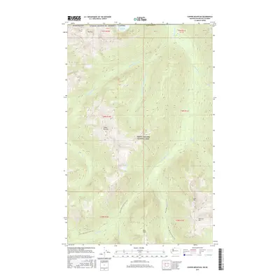
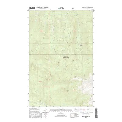
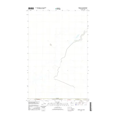
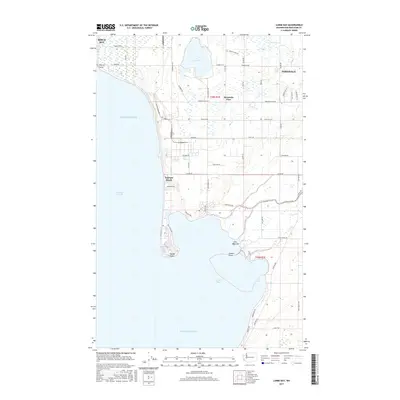
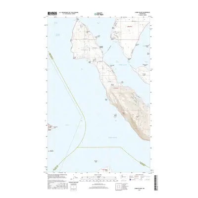
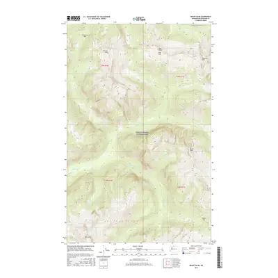
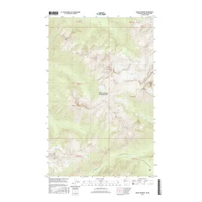
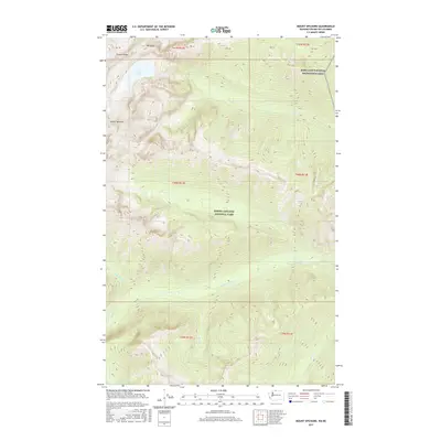
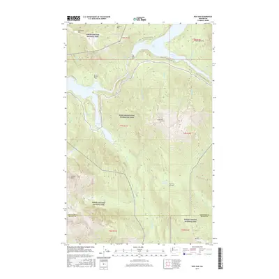
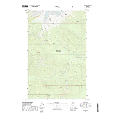
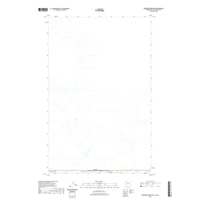
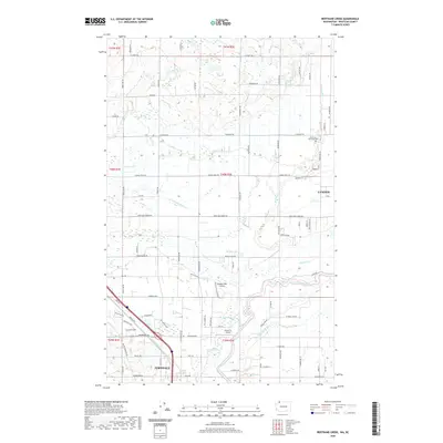
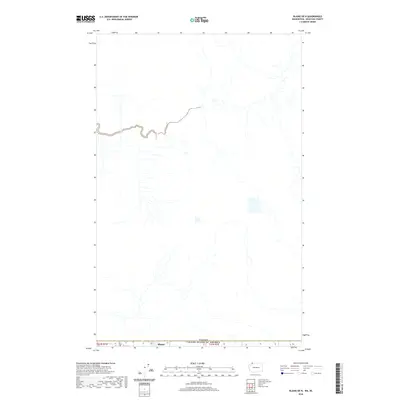
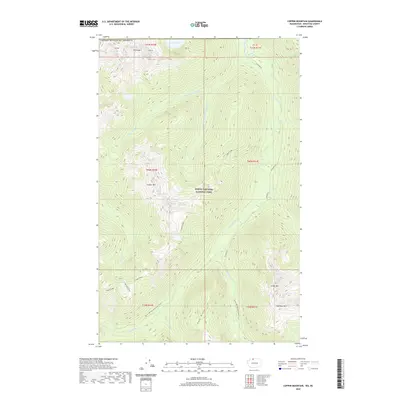
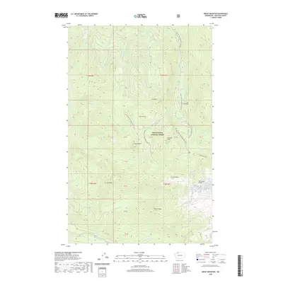
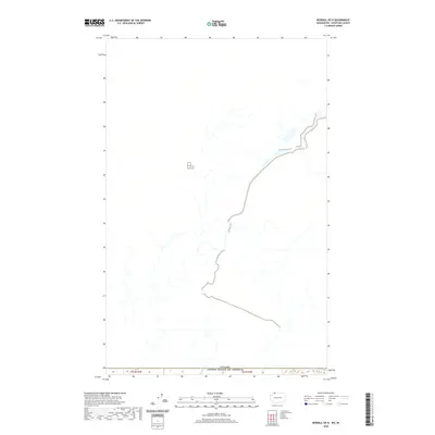
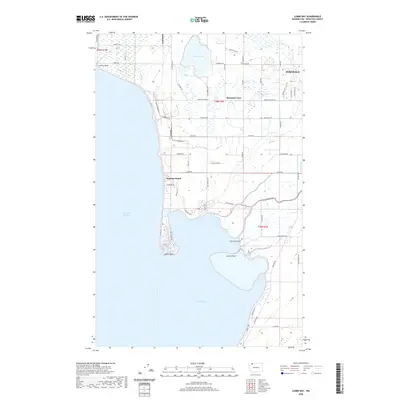
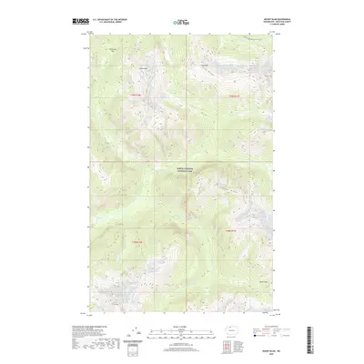
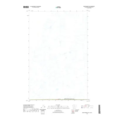
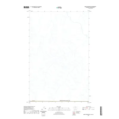
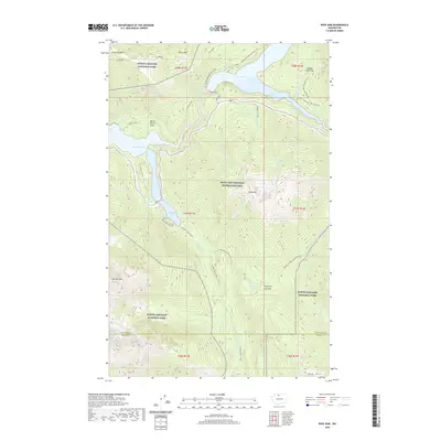
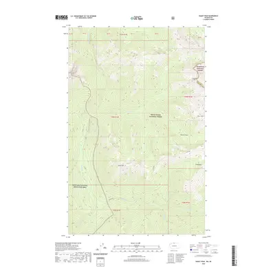
1972 Map of Canyon Lake
USGS Topo · Published 1994About this map
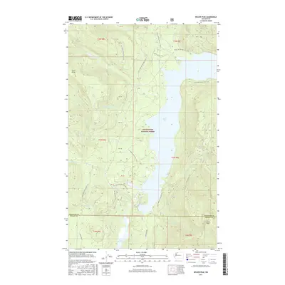
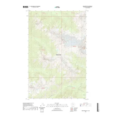
The Middle Fork Nooksack River carves through this portion of the Mt Baker National Forest, revealing a landscape defined by deep drainages and sharp peaks. Water dominates the geography, from the high elevation of Canyon Lake to the lower wetlands of Mosquito Lake and Jorgensen Lake. The presence of a Diversion Dam on the river suggests early water management and industrial utility in this high-relief terrain.
Find a feature on this map
22 named features on this map. Tap any name to fly to it.
Don’t see what you’re looking for? This feature index may not catch every label — zoom into the map to look around manually.
Map Details
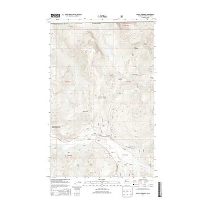
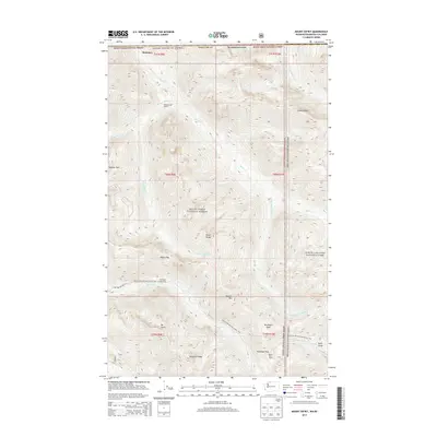
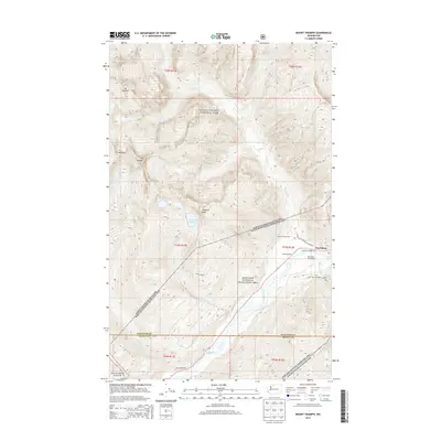
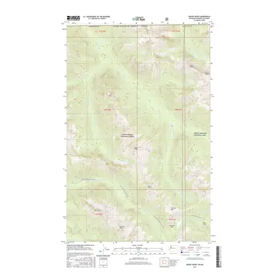
Editions of this 1972 Canyon Lake Map
2 editions found
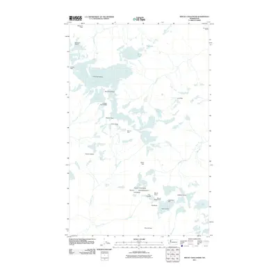
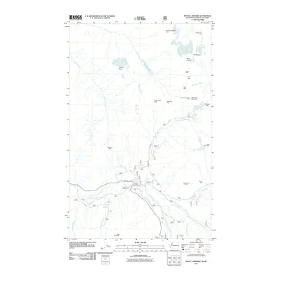
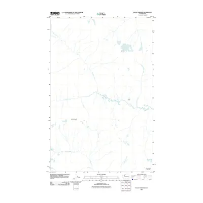
Historical Maps of Whatcom County Through Time
322 maps found

1909 Mt. Baker
Whatcom County, WA

1915 Mt. Baker Dist
Whatcom County, WA

1919 Van Zandt
Whatcom County, WA

1951 Van Zandt
Whatcom County, WA

1952 Bertrand Creek
Whatcom County, WA

1952 Birch Point
Whatcom County, WA

1952 Lake Whatcom
Whatcom County, WA

1952 Lawrence
Whatcom County, WA

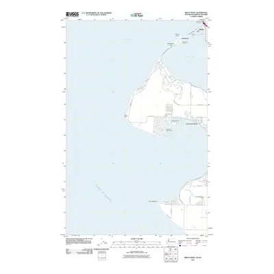
1952 Lummi Bay
Whatcom County, WA

1952 Mt. Baker
Whatcom County, WA

1953 Mt Challenger
Whatcom County, WA

1953 Mt Shuksan
Whatcom County, WA

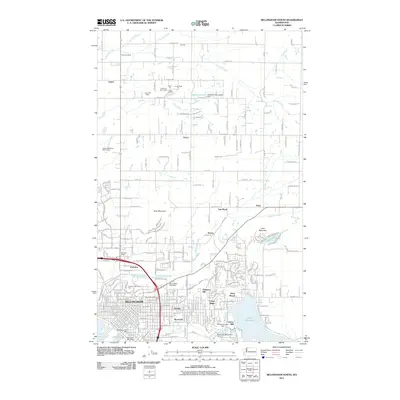
1954 Bellingham North
Whatcom County, WA

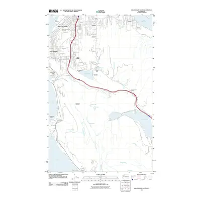
1954 Bellingham South
Whatcom County, WA

1957 Victoria
Whatcom County, WA

1963 Azurite Peak
Whatcom County, WA

1963 Crater Mountain
Whatcom County, WA

1963 Diablo Dam
Whatcom County, WA

1963 Ross Dam
Whatcom County, WA

1969 Hozomeen Mtn
Whatcom County, WA

1969 Jack Mtn
Whatcom County, WA

1969 Mt Prophet
Whatcom County, WA

1969 Mt Spickard
Whatcom County, WA

1969 Pumpkin Mtn.
Whatcom County, WA

1969 Shull Mtn.
Whatcom County, WA

1969 Skagit Peak
Whatcom County, WA
1972 Canyon Lake
Whatcom County, WA

1977 Eliza Island
Whatcom County, WA

1978 Lummi Island
Whatcom County, WA

1979 Mt. Baker
Whatcom County, WA

1980 Cavanaugh Creek
Whatcom County, WA

1989 Bacon Peak
Whatcom County, WA

1989 Baker Pass
Whatcom County, WA

1989 Bearpaw Mountain
Whatcom County, WA

1989 Copper Mountain
Whatcom County, WA

1989 Damnation Peak
Whatcom County, WA

1989 Groat Mountain
Whatcom County, WA

1989 Mount Baker
Whatcom County, WA

1989 Mount Blum
Whatcom County, WA

1989 Mount Sefrit
Whatcom County, WA

1989 Mount Shuksan
Whatcom County, WA

1989 Mount Triumph
Whatcom County, WA

1989 Mt Challenger
Whatcom County, WA

1989 Mt Larrabee
Whatcom County, WA

1989 Mt Redoubt
Whatcom County, WA

1989 Shuksan Arm
Whatcom County, WA

1989 Twin Sisters Mtn.
Whatcom County, WA

1989 Welker Peak
Whatcom County, WA

1998 Bellingham South
Whatcom County, WA

1998 Eliza Island
Whatcom County, WA

1998 Lummi Island
Whatcom County, WA

1999 Bacon Peak
Whatcom County, WA

1999 Damnation Peak
Whatcom County, WA

1999 Mount Triumph
Whatcom County, WA

2002 Azurite Peak
Whatcom County, WA

2002 Castle Peak
Whatcom County, WA

2002 Hozomeen Mountain
Whatcom County, WA

2002 Jack Mountain
Whatcom County, WA

2002 Pumpkin Mountain
Whatcom County, WA

2002 Shull Mountain
Whatcom County, WA

2002 Skagit Peak
Whatcom County, WA

2011 Azurite Peak
Whatcom County, WA
2011 Bacon Peak
Whatcom County, WA
2011 Baker Pass
Whatcom County, WA
2011 Bearpaw Mountain
Whatcom County, WA
2011 Bellingham North
Whatcom County, WA
2011 Bellingham South
Whatcom County, WA

2011 Bertrand Creek
Whatcom County, WA
2011 Birch Point
Whatcom County, WA
2011 Canyon Lake
Whatcom County, WA
2011 Castle Peak
Whatcom County, WA
2011 Cavanaugh Creek
Whatcom County, WA
2011 Copper Mountain
Whatcom County, WA
2011 Crater Mountain
Whatcom County, WA
2011 Damnation Peak
Whatcom County, WA
2011 Diablo Dam
Whatcom County, WA
2011 Eliza Island
Whatcom County, WA
2011 Groat Mountain
Whatcom County, WA
2011 Hozomeen Mountain
Whatcom County, WA
2011 Jack Mountain
Whatcom County, WA
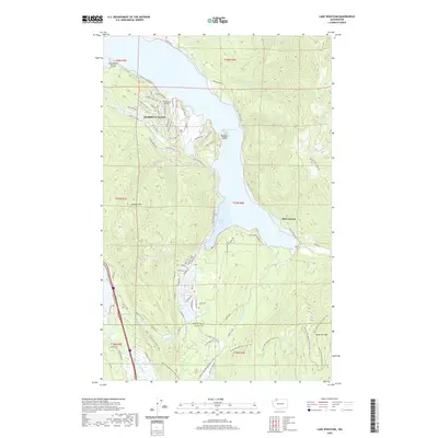
2011 Lake Whatcom
Whatcom County, WA
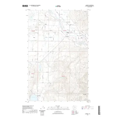
2011 Lawrence
Whatcom County, WA
2011 Lummi Bay OE W
Whatcom County, WA
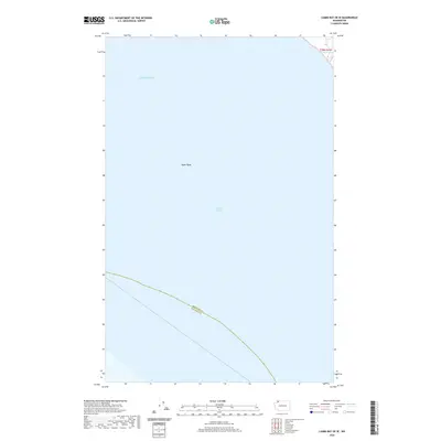
2011 Lummi Bay
Whatcom County, WA
2011 Lummi Island
Whatcom County, WA
2011 Mount Baker
Whatcom County, WA
2011 Mount Blum
Whatcom County, WA
2011 Mount Challenger
Whatcom County, WA
2011 Mount Larrabee
Whatcom County, WA
2011 Mount Prophet
Whatcom County, WA
2011 Mount Redoubt
Whatcom County, WA
2011 Mount Sefrit
Whatcom County, WA
2011 Mount Shuksan
Whatcom County, WA
2011 Mount Spickard
Whatcom County, WA
2011 Mount Triumph
Whatcom County, WA
2011 Pumpkin Mountain
Whatcom County, WA
2011 Ross Dam
Whatcom County, WA

2011 Shuksan Arm
Whatcom County, WA
2011 Shull Mountain
Whatcom County, WA
2011 Skagit Peak
Whatcom County, WA
2011 Twin Sisters Mountain
Whatcom County, WA
2011 Welker Peak
Whatcom County, WA
2014 Azurite Peak
Whatcom County, WA
2014 Bacon Peak
Whatcom County, WA
2014 Baker Pass
Whatcom County, WA
2014 Bearpaw Mountain
Whatcom County, WA
2014 Bellingham North
Whatcom County, WA
2014 Bellingham South
Whatcom County, WA
2014 Bertrand Creek OE N
Whatcom County, WA
2014 Bertrand Creek
Whatcom County, WA
2014 Birch Point OE N
Whatcom County, WA
2014 Birch Point
Whatcom County, WA
2014 Blaine OE N
Whatcom County, WA
2014 Canyon Lake
Whatcom County, WA
2014 Castle Peak
Whatcom County, WA
2014 Cavanaugh Creek
Whatcom County, WA
2014 Copper Mountain
Whatcom County, WA
2014 Crater Mountain
Whatcom County, WA
2014 Damnation Peak
Whatcom County, WA
2014 Diablo Dam
Whatcom County, WA
2014 Eliza Island
Whatcom County, WA

2014 Glacier OE N
Whatcom County, WA
2014 Groat Mountain
Whatcom County, WA
2014 Hozomeen Mountain OE N
Whatcom County, WA
2014 Hozomeen Mountain
Whatcom County, WA
2014 Jack Mountain
Whatcom County, WA
2014 Kendall OE N
Whatcom County, WA
2014 Lake Whatcom
Whatcom County, WA
2014 Lawrence
Whatcom County, WA
2014 Lummi Bay OE W
Whatcom County, WA
2014 Lummi Bay
Whatcom County, WA
2014 Lummi Island
Whatcom County, WA
2014 Lynden OE N
Whatcom County, WA
2014 Maple Falls OE N
Whatcom County, WA
2014 Mount Baker
Whatcom County, WA
2014 Mount Blum
Whatcom County, WA
2014 Mount Challenger
Whatcom County, WA
2014 Mount Larrabee
Whatcom County, WA
2014 Mount Prophet
Whatcom County, WA
2014 Mount Redoubt OE N
Whatcom County, WA
2014 Mount Redoubt
Whatcom County, WA
2014 Mount Sefrit
Whatcom County, WA
2014 Mount Shuksan
Whatcom County, WA
2014 Mount Spickard OE N
Whatcom County, WA
2014 Mount Spickard
Whatcom County, WA
2014 Mount Triumph
Whatcom County, WA

2014 Point Roberts OE N
Whatcom County, WA
2014 Pumpkin Mountain
Whatcom County, WA
2014 Ross Dam
Whatcom County, WA
2014 Shuksan Arm
Whatcom County, WA
2014 Shull Mountain
Whatcom County, WA
2014 Skagit Peak OE N
Whatcom County, WA
2014 Skagit Peak
Whatcom County, WA
2014 Strait of Georgia (All Water)
Whatcom County, WA
2014 Sumas OE N
Whatcom County, WA

2014 Twin Sisters Mountain
Whatcom County, WA
2014 Welker Peak
Whatcom County, WA
2017 Azurite Peak
Whatcom County, WA
2017 Bacon Peak
Whatcom County, WA
2017 Baker Pass
Whatcom County, WA

2017 Bearpaw Mountain
Whatcom County, WA
2017 Bellingham North
Whatcom County, WA
2017 Bellingham South
Whatcom County, WA
2017 Bertrand Creek OE N
Whatcom County, WA
2017 Bertrand Creek
Whatcom County, WA
2017 Birch Point OE N
Whatcom County, WA
2017 Birch Point
Whatcom County, WA
2017 Blaine OE N
Whatcom County, WA
2017 Canyon Lake
Whatcom County, WA
2017 Castle Peak
Whatcom County, WA
2017 Cavanaugh Creek
Whatcom County, WA
2017 Copper Mountain
Whatcom County, WA

2017 Crater Mountain
Whatcom County, WA
2017 Damnation Peak
Whatcom County, WA
2017 Diablo Dam
Whatcom County, WA

2017 Eliza Island
Whatcom County, WA
2017 Glacier OE N
Whatcom County, WA
2017 Groat Mountain
Whatcom County, WA
2017 Hozomeen Mountain OE N
Whatcom County, WA
2017 Hozomeen Mountain
Whatcom County, WA
2017 Jack Mountain
Whatcom County, WA
2017 Kendall OE N
Whatcom County, WA
2017 Lake Whatcom
Whatcom County, WA
2017 Lawrence
Whatcom County, WA
2017 Lummi Bay OE W
Whatcom County, WA
2017 Lummi Bay
Whatcom County, WA
2017 Lummi Island
Whatcom County, WA

2017 Lynden OE N
Whatcom County, WA
2017 Maple Falls OE N
Whatcom County, WA
2017 Mount Baker
Whatcom County, WA
2017 Mount Blum
Whatcom County, WA
2017 Mount Challenger
Whatcom County, WA
2017 Mount Larrabee
Whatcom County, WA

2017 Mount Prophet
Whatcom County, WA
2017 Mount Redoubt OE N
Whatcom County, WA
2017 Mount Redoubt
Whatcom County, WA
2017 Mount Sefrit
Whatcom County, WA
2017 Mount Shuksan
Whatcom County, WA
2017 Mount Spickard OE N
Whatcom County, WA
2017 Mount Spickard
Whatcom County, WA
2017 Mount Triumph
Whatcom County, WA
2017 Point Roberts OE N
Whatcom County, WA
2017 Pumpkin Mountain
Whatcom County, WA
2017 Ross Dam
Whatcom County, WA
2017 Shuksan Arm
Whatcom County, WA
2017 Shull Mountain
Whatcom County, WA

2017 Skagit Peak OE N
Whatcom County, WA

2017 Skagit Peak
Whatcom County, WA
2017 Strait of Georgia (All Water)
Whatcom County, WA
2017 Sumas OE N
Whatcom County, WA

2017 Twin Sisters Mountain
Whatcom County, WA
2017 Welker Peak
Whatcom County, WA
2020 Azurite Peak
Whatcom County, WA
2020 Bacon Peak
Whatcom County, WA
2020 Baker Pass
Whatcom County, WA
2020 Bearpaw Mountain
Whatcom County, WA
2020 Bellingham North
Whatcom County, WA
2020 Bellingham South
Whatcom County, WA
2020 Bertrand Creek OE N
Whatcom County, WA
2020 Bertrand Creek
Whatcom County, WA
2020 Birch Point OE N
Whatcom County, WA
2020 Birch Point
Whatcom County, WA
2020 Blaine OE N
Whatcom County, WA
2020 Canyon Lake
Whatcom County, WA
2020 Castle Peak
Whatcom County, WA
2020 Cavanaugh Creek
Whatcom County, WA
2020 Copper Mountain
Whatcom County, WA
2020 Crater Mountain
Whatcom County, WA

2020 Damnation Peak
Whatcom County, WA
2020 Diablo Dam
Whatcom County, WA
2020 Eliza Island
Whatcom County, WA

2020 Glacier OE N
Whatcom County, WA
2020 Groat Mountain
Whatcom County, WA
2020 Hozomeen Mountain OE N
Whatcom County, WA
2020 Hozomeen Mountain
Whatcom County, WA
2020 Jack Mountain
Whatcom County, WA
2020 Kendall OE N
Whatcom County, WA
2020 Lake Whatcom
Whatcom County, WA
2020 Lawrence
Whatcom County, WA
2020 Lummi Bay OE W
Whatcom County, WA
2020 Lummi Bay
Whatcom County, WA
2020 Lummi Island
Whatcom County, WA

2020 Lynden OE N
Whatcom County, WA
2020 Maple Falls OE N
Whatcom County, WA
2020 Mount Baker
Whatcom County, WA
2020 Mount Blum
Whatcom County, WA
2020 Mount Challenger
Whatcom County, WA
2020 Mount Larrabee
Whatcom County, WA
2020 Mount Prophet
Whatcom County, WA
2020 Mount Redoubt OE N
Whatcom County, WA
2020 Mount Redoubt
Whatcom County, WA
2020 Mount Sefrit
Whatcom County, WA
2020 Mount Shuksan
Whatcom County, WA
2020 Mount Spickard OE N
Whatcom County, WA
2020 Mount Spickard
Whatcom County, WA
2020 Mount Triumph
Whatcom County, WA

2020 Point Roberts OE N
Whatcom County, WA
2020 Pumpkin Mountain
Whatcom County, WA
2020 Ross Dam
Whatcom County, WA
2020 Shuksan Arm
Whatcom County, WA
2020 Shull Mountain
Whatcom County, WA
2020 Skagit Peak OE N
Whatcom County, WA
2020 Skagit Peak
Whatcom County, WA
2020 Strait of Georgia (All Water)
Whatcom County, WA
2020 Sumas OE N
Whatcom County, WA

2020 Twin Sisters Mountain
Whatcom County, WA
2020 Welker Peak
Whatcom County, WA

2023 Azurite Peak
Whatcom County, WA

2023 Bacon Peak
Whatcom County, WA

2023 Baker Pass
Whatcom County, WA

2023 Bearpaw Mountain
Whatcom County, WA

2023 Bellingham North
Whatcom County, WA

2023 Bellingham South
Whatcom County, WA

2023 Bertrand Creek OE N
Whatcom County, WA

2023 Bertrand Creek
Whatcom County, WA

2023 Birch Point OE N
Whatcom County, WA

2023 Birch Point
Whatcom County, WA

2023 Blaine OE N
Whatcom County, WA

2023 Canyon Lake
Whatcom County, WA

2023 Castle Peak
Whatcom County, WA

2023 Cavanaugh Creek
Whatcom County, WA

2023 Copper Mountain
Whatcom County, WA

2023 Crater Mountain
Whatcom County, WA

2023 Damnation Peak
Whatcom County, WA

2023 Diablo Dam
Whatcom County, WA

2023 Eliza Island
Whatcom County, WA

2023 Glacier OE N
Whatcom County, WA

2023 Groat Mountain
Whatcom County, WA

2023 Hozomeen Mountain OE N
Whatcom County, WA

2023 Hozomeen Mountain
Whatcom County, WA

2023 Jack Mountain
Whatcom County, WA

2023 Kendall OE N
Whatcom County, WA

2023 Lake Whatcom
Whatcom County, WA

2023 Lawrence
Whatcom County, WA

2023 Lummi Bay OE W
Whatcom County, WA

2023 Lummi Bay
Whatcom County, WA

2023 Lummi Island
Whatcom County, WA

2023 Lynden OE N
Whatcom County, WA

2023 Maple Falls OE N
Whatcom County, WA

2023 Mount Baker
Whatcom County, WA

2023 Mount Blum
Whatcom County, WA

2023 Mount Challenger
Whatcom County, WA

2023 Mount Larrabee
Whatcom County, WA

2023 Mount Prophet
Whatcom County, WA

2023 Mount Redoubt OE N
Whatcom County, WA

2023 Mount Redoubt
Whatcom County, WA

2023 Mount Sefrit
Whatcom County, WA

2023 Mount Shuksan
Whatcom County, WA

2023 Mount Spickard OE N
Whatcom County, WA

2023 Mount Spickard
Whatcom County, WA

2023 Mount Triumph
Whatcom County, WA

2023 Point Roberts OE N
Whatcom County, WA

2023 Pumpkin Mountain
Whatcom County, WA

2023 Ross Dam
Whatcom County, WA

2023 Shuksan Arm
Whatcom County, WA

2023 Shull Mountain
Whatcom County, WA

2023 Skagit Peak OE N
Whatcom County, WA

2023 Skagit Peak
Whatcom County, WA

2023 Strait of Georgia (All Water)
Whatcom County, WA

2023 Sumas OE N
Whatcom County, WA

2023 Twin Sisters Mountain
Whatcom County, WA

2023 Welker Peak
Whatcom County, WA