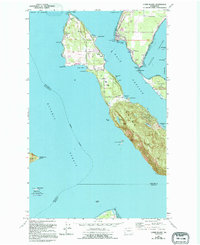
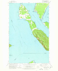
1978 Map of Lummi Island
USGS Topo · Published 1995About this map
Lummi Island is defined by its complex shoreline and maritime orientation, separated from the mainland by Hale Passage. The 1994 revisions highlight the varied land use on the island, ranging from the high elevations of Lummi Peak and Richards Mtn to the coastal settlements at Loganita Lodge and The Willows. A distinct cultural landscape is visible in the northeast, where the Lummi Indian Reservation occupies the mainland shore near Gooseberry Point. The island's geography is punctuated by specific local landmarks such as the Grange Hall and Cem, reflecting a established community structure. Coastal features like Legoe Bay, Smugglers Cove, and Bumstead Spit emphasize the island's interaction with the surrounding Rosario Strait and Portage Channel. This survey also documents the presence of the San Juan Islands National Wildlife Refuge on the outlying Peapod Rocks.
Find a feature on this map
58 named features on this map. Tap any name to fly to it.
Don’t see what you’re looking for? This feature index may not catch every label — zoom into the map to look around manually.
Map Details
Editions of this 1978 Lummi Island Map
2 editions found
Other maps of this area

1907 · Blaine
USGS Topo · 1:62,500

1943 · Orcas Island
USGS Topo · 1:62,500

1943 · Anacortes
USGS Topo · 1:62,500

1951 · Anacortes
USGS Topo · 1:62,500

1952 · Ferndale
USGS Topo · 1:24,000

1952 · Lummi Bay
USGS Topo · 1:24,000

1952 · Blaine
USGS Topo · 1:62,500

1957 · Orcas Island
USGS Topo · 1:62,500

1957 · Victoria
USGS Topo · 1:250,000

1973 · Cypress Island
USGS Topo · 1:24,000