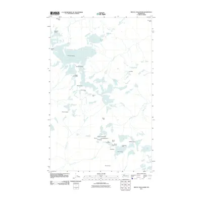
2011 Map of Mount Challenger
USGS Topo · Published 2011About this map
The Picket Range dominates this corner of the North Cascades, defined by a complex network of high-altitude glaciers and jagged summits. Centered on Mount Challenger, the landscape is shaped by the massive Challenger Glacier and the Whatcom Glacier, which feed remote drainage systems like Little Beaver Creek and Picket Creek. This 2011 survey illustrates the dramatic topography of the region, from the steep walls of The Barrier to the sharp points of the Crescent Creek Spires. Human presence is minimal, represented almost exclusively by the Beaver Pass Shelter and the high mountaineering routes through Whatcom Pass and Picket Pass. These remote features, including the aptly named Mount Terror and Phantom Peak, highlight a wilderness area where natural landmarks are the primary identifiers. The map captures the significant ice coverage of the Terror Glacier and smaller alpine bodies like Wiley Lake before further contemporary glacial retreat.
Find a feature on this map
36 named features on this map. Tap any name to fly to it.
Don’t see what you’re looking for? This feature index may not catch every label — zoom into the map to look around manually.
Map Details
Editions of this 2011 Mount Challenger Map
This is the sole edition of this map. No revisions or reprints were ever made.
Other maps of this area

1953 · Marblemount
USGS Topo · 1:62,500

1953 · Mt Challenger
USGS Topo · 1:62,500

1955 · Concrete
USGS Topo · 1:250,000

1958 · Concrete
USGS Topo · 1:250,000

1962 · Concrete
USGS Topo · 1:250,000

1963 · Diablo Dam
USGS Topo · 1:24,000

1969 · Mt Prophet
USGS Topo · 1:24,000
1969 · Mt Spickard
USGS Topo · 1:24,000

1979 · Mt. Baker
USGS Topo · 1:100,000
1989 · Copper Mountain
USGS Topo · 1:24,000