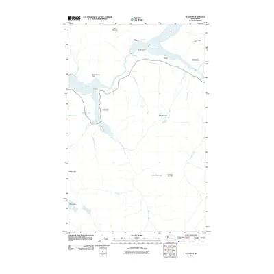
2011 Map of Ross Dam
USGS Topo · Published 2011About this map
Ross Dam serves as the focal point of this North Cascades landscape, holding back the expansive waters of Ross Lake. The settlement of Ross Lake Resort and the Ross Dam District Ranger Office sit along the northern reaches of the reservoir, while further south, the Skagit River connects to Diablo Lake. This 2011 survey documents the established recreational and administrative infrastructure of the region, including the Colonial Creek Campground and Diablo Vista.
Find a feature on this map
34 named features on this map. Tap any name to fly to it.
Don’t see what you’re looking for? This feature index may not catch every label — zoom into the map to look around manually.
Map Details
Editions of this 2011 Ross Dam Map
This is the sole edition of this map. No revisions or reprints were ever made.
Other maps of this area

1920 · Slate Pass
USGS Topo · 1:125,000

1955 · Concrete
USGS Topo · 1:250,000

1958 · Concrete
USGS Topo · 1:250,000

1962 · Concrete
USGS Topo · 1:250,000

1963 · Eldorado Peak
USGS Topo · 1:24,000
1963 · Forbidden Peak
USGS Topo · 1:24,000
1963 · Mt Logan
USGS Topo · 1:24,000

1963 · Crater Mountain
USGS Topo · 1:24,000

1963 · Diablo Dam
USGS Topo · 1:24,000

1963 · Ross Dam
USGS Topo · 1:24,000