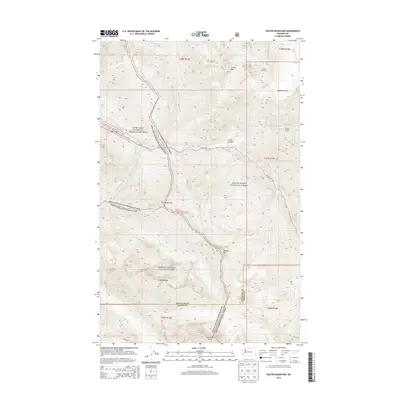
2014 Map of Crater Mountain
USGS Topo · Published 2014About this map
Jerry Glacier and the high-elevation peaks of the northern Cascades dominate this 2014 survey. The landscape is defined by its preserved wilderness, with large portions of the terrain protected within North Cascades National Park, Mount Baker National Forest, and the Ross Lake National Recreation Area. Human activity is primarily limited to recreational and transit corridors, notably the Pacific Crest National Scenic Trail winding through the western half and the N Cascades Hwy (State Route 20) following the course of Canyon Cr and Granite Cr. Significant topographical features such as Crater Mtn and Beebe Mtn rise above the drainage basins of Ruby Cr and Stillwell Cr. Further south, the boundary between Whatcom Co and Skagit Co cuts across the slopes near Gabriel Peak, marking a administrative divide in this largely roadless environment.
Find a feature on this map
33 named features on this map. Tap any name to fly to it.
Don’t see what you’re looking for? This feature index may not catch every label — zoom into the map to look around manually.
Map Details
Editions of this 2014 Crater Mountain Map
This is the sole edition of this map. No revisions or reprints were ever made.
Other maps of this area

1920 · Slate Pass
USGS Topo · 1:125,000

1955 · Concrete
USGS Topo · 1:250,000

1958 · Concrete
USGS Topo · 1:250,000

1962 · Concrete
USGS Topo · 1:250,000

1963 · Azurite Peak
USGS Topo · 1:24,000
1963 · Mt. Arriva
USGS Topo · 1:24,000
1963 · Forbidden Peak
USGS Topo · 1:24,000
1963 · Mt Logan
USGS Topo · 1:24,000

1963 · Crater Mountain
USGS Topo · 1:24,000

1963 · Ross Dam
USGS Topo · 1:24,000