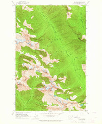
1963 Map of Mt. Arriva
USGS Topo · Published 1964About this map
Mt Baker National Forest and Okanogan National Forest converge at the crest of the Cascades in this 1963 field survey. The high-altitude landscape is defined by massive formations like Ragged Ridge and peaks including Mt Arriva, Black Peak, and Corteo Peak. Glacial features are prominent throughout the quadrangle, notably the Lewis Glacier perched above Wing Lake and Lewis Lake.
Find a feature on this map
30 named features on this map. Tap any name to fly to it.
Don’t see what you’re looking for? This feature index may not catch every label — zoom into the map to look around manually.
Map Details
Editions of this 1963 Mt. Arriva Map
3 editions found
Other maps of this area

1902 · Stehekin
USGS Topo · 1:125,000

1904 · Stehekin
USGS Topo · 1:125,000

1920 · Slate Pass
USGS Topo · 1:125,000

1955 · Concrete
USGS Topo · 1:250,000

1958 · Concrete
USGS Topo · 1:250,000

1962 · Concrete
USGS Topo · 1:250,000

1963 · Washington Pass
USGS Topo · 1:24,000

1963 · Mc Gregor Mtn
USGS Topo · 1:24,000

1963 · Azurite Peak
USGS Topo · 1:24,000

1963 · Slate Peak
USGS Topo · 1:24,000