
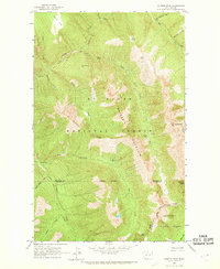
1963 Map of Azurite Peak
USGS Topo · Published 1964About this map
The high alpine intersection of the Mt Baker National Forest and Okanogan National Forest defines this 1963 survey of the North Cascades. High-altitude mining operations are a primary focus, with the Azurite Mine and its associated Tailings positioned near Majestic Mountain, while the North American Mine and Gold Hill Mine sit deep within the drainage basins of Mill Creek and East Creek.
Find a feature on this map
33 named features on this map. Tap any name to fly to it.
Don’t see what you’re looking for? This feature index may not catch every label — zoom into the map to look around manually.
Map Details
Editions of this 1963 Azurite Peak Map
2 editions found
Other maps of this area

1920 · Slate Pass
USGS Topo · 1:125,000

1955 · Concrete
USGS Topo · 1:250,000

1958 · Concrete
USGS Topo · 1:250,000

1962 · Concrete
USGS Topo · 1:250,000

1963 · Washington Pass
USGS Topo · 1:24,000

1963 · Slate Peak
USGS Topo · 1:24,000
1963 · Mt. Arriva
USGS Topo · 1:24,000
1963 · Mt Logan
USGS Topo · 1:24,000

1963 · Crater Mountain
USGS Topo · 1:24,000
1969 · Pasayten Peak
USGS Topo · 1:24,000