
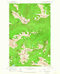
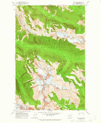
1963 Map of Azurite Peak
USGS Topo · Published 1969About this map
The high mountain mining operations of Mt Baker National Forest and Okanogan National Forest are documented in this 1963 field survey. The rugged landscape is defined by its deep vertical relief and the presence of significant mineral claims, notably the Azurite Mine near Tailings and the North American Mine along the upper reaches of Mill Creek. The map records a transition in mountain access, illustrating the route of the Cascade Crest Trail as it follows the high ridgelines between Azurite Peak and Mt Ballard. These peaks and the surrounding ridges, like McKay Ridge and Majestic Mountain, reveal a topography where early industrial extraction met the increasing interest in high-altitude wilderness recreation. Lower-elevation landmarks like Fourmile Camp and Cedar Crossing suggest the logistical challenges of reaching these remote mining sites before modern road developments.
Find a feature on this map
35 named features on this map. Tap any name to fly to it.
Don’t see what you’re looking for? This feature index may not catch every label — zoom into the map to look around manually.
Map Details
Editions of this 1963 Azurite Peak Map
2 editions found
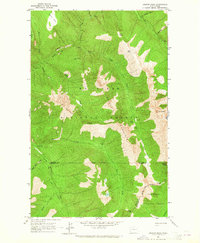
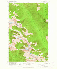
Other maps of this area

1920 · Slate Pass
USGS Topo · 1:125,000

1955 · Concrete
USGS Topo · 1:250,000

1958 · Concrete
USGS Topo · 1:250,000

1962 · Concrete
USGS Topo · 1:250,000
1963 · Washington Pass
USGS Topo · 1:24,000
1963 · Azurite Peak
USGS Topo · 1:24,000
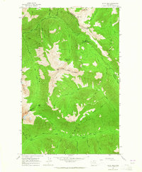
1963 · Slate Peak
USGS Topo · 1:24,000
1963 · Mt. Arriva
USGS Topo · 1:24,000
1963 · Mt Logan
USGS Topo · 1:24,000
1963 · Crater Mountain
USGS Topo · 1:24,000