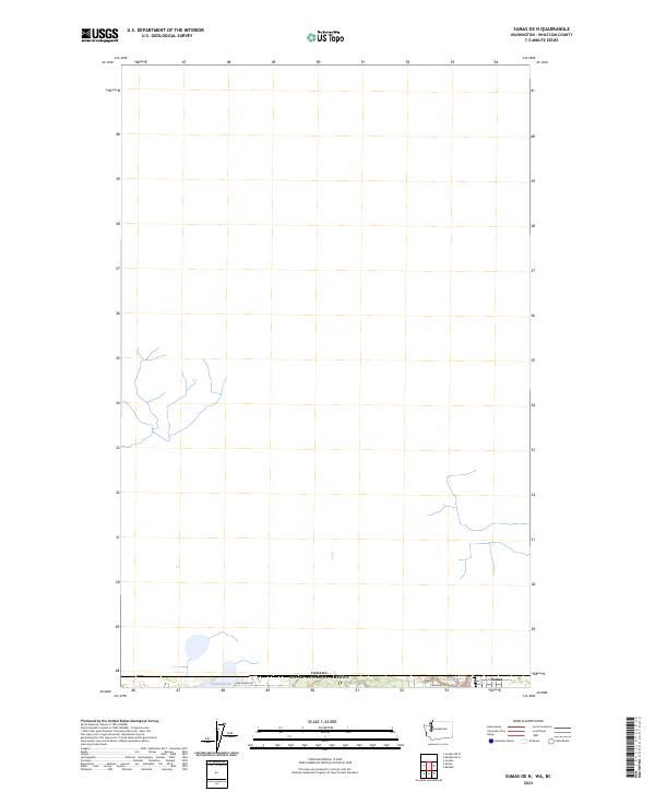
2023 Map of Sumas OE N
USGS Topo · Published 2023About this map
The international border between the Canada United States of America and Washington State defines the southern edge of this map, focusing on the immediate surroundings of Sumas. This frontier landscape is characterized by its agricultural grid and the presence of Judson Lake, which sits directly against the boundary line. The northern portion of the map remains largely dominated by the natural drainage patterns and open terrain typical of the Fraser Lowland, showing how the land stretches toward the horizon north of the border. Local transit and property access are anchored by roads such as Van Buren Rd and Kneuman Rd, which serve the rural parcels and residential streets like Arthur St on the outskirts of the settlement.
Find a feature on this map
8 named features on this map. Tap any name to fly to it.
Don’t see what you’re looking for? This feature index may not catch every label — zoom into the map to look around manually.
Map Details
Editions of this 2023 Sumas OE N Map
This is the sole edition of this map. No revisions or reprints were ever made.
Other maps of this area

1906 · Sumas
USGS Topo · 1:62,500

1908 · Sumas
USGS Topo · 1:62,500

1919 · Van Zandt
USGS Topo · 1:62,500

1951 · Van Zandt
USGS Topo · 1:62,500

1952 · Lynden
USGS Topo · 1:24,000

1952 · Sumas
USGS Topo · 1:24,000

1954 · Lynden
USGS Topo · 1:62,500

1957 · Victoria
USGS Topo · 1:250,000
1972 · Kendall
USGS Topo · 1:24,000

1975 · Bellingham
USGS Topo · 1:100,000