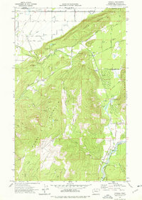
1972 Map of Kendall
USGS Topo · Published 1976About this map
Sumas Mountain and Vedder Mountain dominate the topography of this corner of Whatcom County, where the Canadian border cuts across the northern edge of the sheet near Saar Creek. The landscape in the early 1970s is a mix of dense forest, steep ridges, and active industry, evidenced by numerous quarries and gravel pits scattered near Limestone Junction and Hilltop. The Nooksack River and its north fork wind through the southeastern lowlands, supporting the Nooksack Salmon Hatchery near the settlement of Kendall. Local history is preserved at the Sumas IOOF Cem and St Peters Cem, while the former rail infrastructure of the Chicago Milwaukee St Paul and Pacific and various old grade roads trace the movement of timber and minerals through Pass Valley.
Find a feature on this map
60 named features on this map. Tap any name to fly to it.
Don’t see what you’re looking for? This feature index may not catch every label — zoom into the map to look around manually.
Map Details
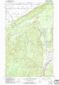
Editions of this 1972 Kendall Map
2 editions found
Other maps of this area

1906 · Sumas
USGS Topo · 1:62,500

1908 · Sumas
USGS Topo · 1:62,500

1919 · Van Zandt
USGS Topo · 1:62,500

1951 · Van Zandt
USGS Topo · 1:62,500

1952 · Lawrence
USGS Topo · 1:24,000

1952 · Sumas
USGS Topo · 1:24,000

1954 · Lynden
USGS Topo · 1:62,500

1957 · Victoria
USGS Topo · 1:250,000

1972 · Maple Falls
USGS Topo · 1:24,000
1972 · Canyon Lake
USGS Topo · 1:24,000