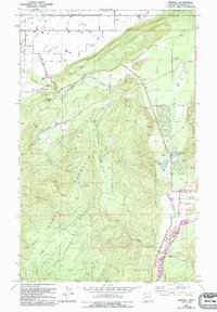
1972 Map of Kendall
USGS Topo · Published 1994About this map
Sumas Mountain and Columbia Mountain dominate this corner of the Pacific Northwest, framing a valley where water and industry shaped the local geography. The mapping of the North Fork Nooksack River and its tributaries, such as Saar Creek and Kendall Lake, illustrates a landscape of active resource management. The map details the transition from high-elevation peaks like Vedder Mountain to the functional sites of the lowlands, including the Nooksack Salmon Hatchery and several quarries and gravel pits. Settlement patterns are evident in the locations of Kendall and Columbia, while the Balford (Site) suggests a location that had already changed by the time of the late 20th-century revisions. Genealogists can find the IOOF Cem and St Peters Cem, providing clear spatial context for local family histories near the international border with Canada.
Find a feature on this map
54 named features on this map. Tap any name to fly to it.
Don’t see what you’re looking for? This feature index may not catch every label — zoom into the map to look around manually.
Map Details
Editions of this 1972 Kendall Map
2 editions found
Other maps of this area

1906 · Sumas
USGS Topo · 1:62,500

1908 · Sumas
USGS Topo · 1:62,500

1919 · Van Zandt
USGS Topo · 1:62,500

1951 · Van Zandt
USGS Topo · 1:62,500

1952 · Lawrence
USGS Topo · 1:24,000

1952 · Sumas
USGS Topo · 1:24,000

1954 · Lynden
USGS Topo · 1:62,500

1957 · Victoria
USGS Topo · 1:250,000

1972 · Maple Falls
USGS Topo · 1:24,000
1972 · Kendall
USGS Topo · 1:24,000