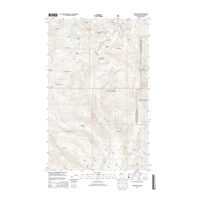
2014 Map of Shuksan Arm
USGS Topo · Published 2014About this map
Mount Baker Lodge and the Mount Baker Ski Resort anchor the high-altitude development shown in this 2014 survey of the North Cascades. The landscape is defined by the massive glacial systems of the Mount Baker National Forest, including the Table Mountain Glacier, White Salmon Glacier, and Lower Curtis Glacier. Human presence in this alpine environment is centered at Heather Meadows and Galena Camp, where the Mt Baker Hwy terminates near Austin Pass. This map records the modern state of these recreational landmarks and the intricate hydrography of the high country, such as the Bagley Lakes and Picture Lake. Further south, the Pacific NW National Scenic Trail traverses the Lava Divide, passing remote sites like Baker Hot Spring and the steep terrain of Avalanche Gorge.
Find a feature on this map
56 named features on this map. Tap any name to fly to it.
Don’t see what you’re looking for? This feature index may not catch every label — zoom into the map to look around manually.
Map Details
Editions of this 2014 Shuksan Arm Map
This is the sole edition of this map. No revisions or reprints were ever made.
Other maps of this area

1909 · Mt Baker
USGS Topo · 1:192,000

1915 · Mt. Baker
USGS Topo · 1:250,000

1952 · Lake Shannon
USGS Topo · 1:62,500

1952 · Mt. Baker
USGS Topo · 1:62,500

1952 · Hamilton
USGS Topo · 1:62,500

1953 · Mt Shuksan
USGS Topo · 1:62,500

1955 · Concrete
USGS Topo · 1:250,000

1958 · Concrete
USGS Topo · 1:250,000

1962 · Concrete
USGS Topo · 1:250,000
1973 · Hamilton
USGS Topo · 1:62,500