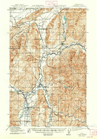
1919 Map of Van Zandt
USGS Topo · Published 1947About this map
The Nooksack River valley at the close of the Great War was a hive of industrial activity driven by timber and mineral extraction. This survey reveals a landscape punctuated by resource-heavy infrastructure, from the Olympic Portland Cement Company and International Lime Plant to the Old Nooksack Mine on Sumas Mountain. Settlement patterns were largely dictated by the arrival of the Chicago Milwaukee and St Paul RR and the Northern Pacific RR, which facilitated the growth of towns like Maple Falls, Kendall, and Deming.
Find a feature on this map
57 named features on this map. Tap any name to fly to it.
Don’t see what you’re looking for? This feature index may not catch every label — zoom into the map to look around manually.
Map Details
Editions of this 1919 Van Zandt Map
2 editions found
Other maps of this area

1906 · Sumas
USGS Topo · 1:62,500

1908 · Sumas
USGS Topo · 1:62,500

1909 · Mt Baker
USGS Topo · 1:192,000

1915 · Mt. Baker
USGS Topo · 1:250,000

1918 · Samish Lake
USGS Topo · 1:62,500

1919 · Van Zandt
USGS Topo · 1:62,500

1921 · Wickersham
USGS Topo · 1:62,500

1951 · Wickersham
USGS Topo · 1:62,500

1951 · Van Zandt
USGS Topo · 1:62,500

1952 · Lake Whatcom
USGS Topo · 1:24,000