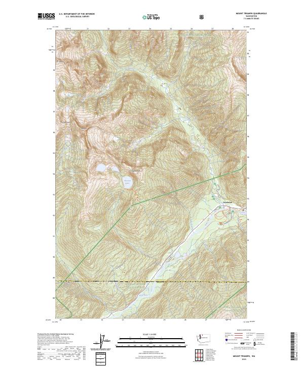
2023 Map of Mount Triumph
USGS Topo · Published 2023About this map
Newhalem serves as a primary access point to the high peaks and river valleys of the North Cascades, situated where the Skagit River meets Newhalem Creek. The map illustrates a landscape shaped by significant elevation changes and glacial runoff, with Goodell Creek and Thornton Creek feeding into the main river channel from the surrounding massifs. High-altitude features like Thornton Lakes and Mt Triumph dominate the western portion of the quadrangle, while the east is characterized by the steep canyons of Terror Creek and Stetattle Creek. Human infrastructure is concentrated near the river, including the North Cascades Visitor Center and specialized local routes like Powerhouse Road and Skagit River Loop. These roads facilitate access to the Ross Lake National Recreation Area and the Stephen Mather Wilderness, highlighting the area's modern role as a protected sanctuary for backcountry exploration and hydroelectric management.
Find a feature on this map
33 named features on this map. Tap any name to fly to it.
Don’t see what you’re looking for? This feature index may not catch every label — zoom into the map to look around manually.
Map Details
Editions of this 2023 Mount Triumph Map
This is the sole edition of this map. No revisions or reprints were ever made.
Other maps of this area

1953 · Marblemount
USGS Topo · 1:62,500

1953 · Mt Challenger
USGS Topo · 1:62,500

1955 · Concrete
USGS Topo · 1:250,000

1958 · Concrete
USGS Topo · 1:250,000

1962 · Concrete
USGS Topo · 1:250,000

1963 · Eldorado Peak
USGS Topo · 1:24,000

1963 · Diablo Dam
USGS Topo · 1:24,000

1969 · Mt Prophet
USGS Topo · 1:24,000

1979 · Mt. Baker
USGS Topo · 1:100,000
1989 · Marblemount
USGS Topo · 1:24,000