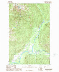
1989 Map of Marblemount
USGS Topo · Published 1989About this map
Skagit River and Cascade River converge near the settlement of Marblemount, a key junction in the high country of the Pacific Northwest. This late-1980s landscape is defined by its complex jurisdictional boundaries, where the North Cascades National Park meets the Mt Baker National Forest and the Noisy-Diobsud Wilderness. The survey captures the transition from the river valleys to the high peaks of the Diobsud Buttes and Helen Buttes.
Find a feature on this map
31 named features on this map. Tap any name to fly to it.
Don’t see what you’re looking for? This feature index may not catch every label — zoom into the map to look around manually.
Map Details
Editions of this 1989 Marblemount Map
This is the sole edition of this map. No revisions or reprints were ever made.
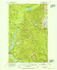
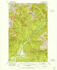
Other maps of this area

1899 · Glacier Peak
USGS Topo · 1:125,000

1899 · Stillaguamish
USGS Topo · 1:125,000

1901 · Glacier Peak
USGS Topo · 1:125,000

1901 · Stilaguamish
USGS Topo · 1:125,000

1909 · Mt Baker
USGS Topo · 1:192,000

1915 · Mt. Baker
USGS Topo · 1:250,000
1952 · Lake Shannon
USGS Topo · 1:62,500
1953 · Marblemount
USGS Topo · 1:62,500

1955 · Concrete
USGS Topo · 1:250,000

1958 · Concrete
USGS Topo · 1:250,000