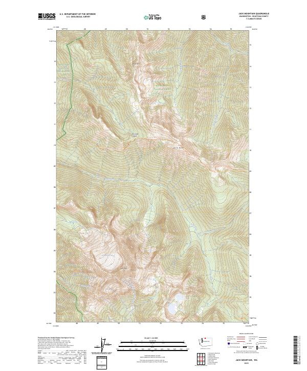
2023 Map of Jack Mountain
USGS Topo · Published 2023About this map
Jack Mtn anchors this high-elevation corner of the North Cascades, where glacial activity and steep drainages define the landscape. The Nohokomeen Glacier clings to the slopes of this prominent peak, feeding a network of streams including Devils Creek and Crater Creek. This terrain is preserved within a massive complex of protected lands, where the boundaries of the Stephen Mather Wilderness, Pasayten Wilderness, and Mount Baker National Forest converge.
Find a feature on this map
24 named features on this map. Tap any name to fly to it.
Don’t see what you’re looking for? This feature index may not catch every label — zoom into the map to look around manually.
Map Details
Editions of this 2023 Jack Mountain Map
This is the sole edition of this map. No revisions or reprints were ever made.
Other maps of this area

1920 · Slate Pass
USGS Topo · 1:125,000

1955 · Concrete
USGS Topo · 1:250,000

1958 · Concrete
USGS Topo · 1:250,000

1962 · Concrete
USGS Topo · 1:250,000

1963 · Azurite Peak
USGS Topo · 1:24,000

1963 · Crater Mountain
USGS Topo · 1:24,000

1963 · Ross Dam
USGS Topo · 1:24,000

1969 · Skagit Peak
USGS Topo · 1:24,000
1969 · Jack Mtn
USGS Topo · 1:24,000
1969 · Shull Mtn.
USGS Topo · 1:24,000