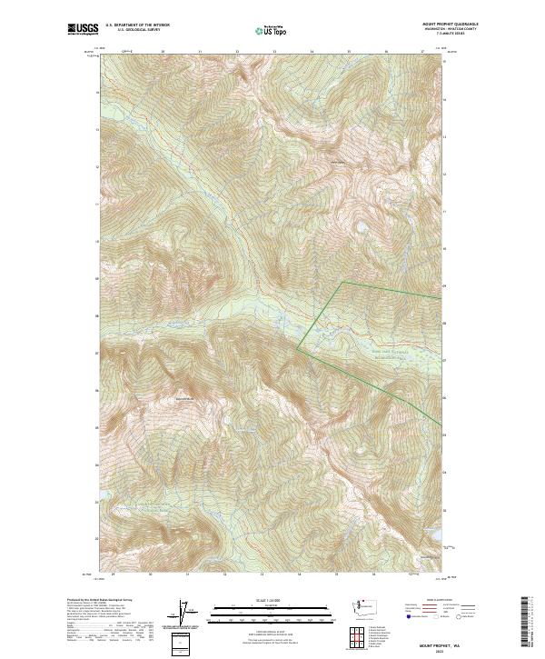
2023 Map of Mount Prophet
USGS Topo · Published 2023About this map
Mt Prophet towers over a landscape defined by deep drainages and federal conservation boundaries in the Cascades of Whatcom County. This contemporary study shows the convergence of the Stephen Mather Wilderness, Ross Lake National Recreation Area, and North Cascades National Park. The topography is etched by high alpine waters including Big Beaver Creek, McMillan Creek, and Torrent Creek, which descend from summits like Elephant Butte. The map documents critical transit corridors through this protected backcountry, notably the Pacific Northwest National Scenic Trl and the Stetattle Creek Trl. High-altitude features like Sourdough Lake and the peak of Sourdough Mtn mark the southern reaches of the quadrangle, illustrating the preserved state of this high-elevation wilderness in the early twenty-first century.
Find a feature on this map
21 named features on this map. Tap any name to fly to it.
Don’t see what you’re looking for? This feature index may not catch every label — zoom into the map to look around manually.
Map Details
Editions of this 2023 Mount Prophet Map
This is the sole edition of this map. No revisions or reprints were ever made.
Other maps of this area

1953 · Marblemount
USGS Topo · 1:62,500

1953 · Mt Challenger
USGS Topo · 1:62,500

1955 · Concrete
USGS Topo · 1:250,000

1958 · Concrete
USGS Topo · 1:250,000

1962 · Concrete
USGS Topo · 1:250,000

1963 · Diablo Dam
USGS Topo · 1:24,000

1963 · Ross Dam
USGS Topo · 1:24,000

1969 · Mt Prophet
USGS Topo · 1:24,000
1969 · Pumpkin Mtn.
USGS Topo · 1:24,000
1969 · Hozomeen Mtn
USGS Topo · 1:24,000