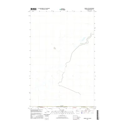
2017 Map of Kendall OE N
USGS Topo · Published 2017About this map
The international border between the Canada United States of America is the central focus of this 2017 survey, mapping the point where Washington meets British Columbia. Situated within Whatcom Co, the landscape is primarily defined by the jurisdictional grid of the Public Land Survey System, including sections within t41n r4e 36 and t41n r5e 33. The geography reflects the high-latitude drainage patterns of the Pacific Northwest, with numerous unnamed tributaries and seasonal wetlands flowing across the boundary line. This map is a record of the precise administrative demarcation between two nations, showing the exact path of the border as it traverses the remote forest and river drainages of the northern Cascades foothills.
Find a feature on this map
5 named features on this map. Tap any name to fly to it.
Don’t see what you’re looking for? This feature index may not catch every label — zoom into the map to look around manually.
Map Details
Editions of this 2017 Kendall OE N Map
This is the sole edition of this map. No revisions or reprints were ever made.
Other maps of this area

1906 · Sumas
USGS Topo · 1:62,500

1908 · Sumas
USGS Topo · 1:62,500

1919 · Van Zandt
USGS Topo · 1:62,500

1951 · Van Zandt
USGS Topo · 1:62,500

1952 · Sumas
USGS Topo · 1:24,000

1954 · Lynden
USGS Topo · 1:62,500

1957 · Victoria
USGS Topo · 1:250,000

1972 · Maple Falls
USGS Topo · 1:24,000
1972 · Kendall
USGS Topo · 1:24,000

1975 · Bellingham
USGS Topo · 1:100,000